
IMAGES TAKEN NEAR TO
The Orchard, ILKESTON, DE7 4QP
Introduction
This page details the photographs taken nearby to The Orchard, DE7 4QP by members of the Geograph project.
The Geograph project started in 2005 with the aim of publishing, organising and preserving representative images for every square kilometre of Great Britain, Ireland and the Isle of Man.

There are currently over 7.5m images from over14,400 individuals and you can help contribute to the project by visiting https://www.geograph.org.uk
Image Map
Images are licensed for reuse under creativecommons.org/licenses/by-sa/2.0
Notes
- Clicking on the map will re-center to the selected point.
- The higher the marker number, the further away the image location is from the centre of the postcode.
Image Listing (78 Images Found)
Images are licensed for reuse under creativecommons.org/licenses/by-sa/2.0
Image
Details
Distance
1
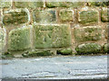
Bench mark, School Lane
See http://www.geograph.org.uk/photo/3489668 for the location. Cut into a block of gritstone in a retaining wall.
Image: © Alan Murray-Rust
Taken: 31 May 2013
0.04 miles
2
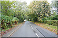
The edge of Stanton by Dale
A leafy road on the edge of Stanton by Dale. Soon the leaves will have fallen as they are turning autumnal.
Image: © Malcolm Neal
Taken: 15 Oct 2019
0.04 miles
3
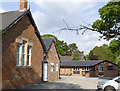
The Old Schoolhouse village shop and tea rooms
These occupy the detached, later, classroom. The Post Office was here until closure in 2007 http://www.geograph.org.uk/photo/577366 but the shop has managed to survive.
Image: © Alan Murray-Rust
Taken: 31 May 2013
0.05 miles
4
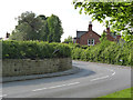
The corner of School Lane
There is a bench mark http://www.geograph.org.uk/photo/3489671 in the stone wall, close to the left edge of the picture, more clearly visible in the high resolution version.
Image: © Alan Murray-Rust
Taken: 31 May 2013
0.05 miles
5
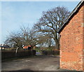
Stanton-by-Dale, Derbys.
Part of the former school, dating from 1853. It now serves as a community hall. The picture is taken from its car park that it shares with a "Deli-Café and Shop" to the rear of the school. The single storey premises currently occupied by the Deli-Café previously housed a Post Office & village shop between 2007-2008. School Lane is visible on the other side of the hedge.
Image: © David Hallam-Jones
Taken: 16 Feb 2013
0.05 miles
6
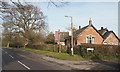
Stanton-by-Dale, Derbys.
This former school is enclosed in a letter c-shaped pattern by three roads. School Lane and The Spinney are seen here and Quarry Hill lies beyond the furthest tree. The school, dating from 1853, now serves as a community hall and behind it, facing the rear of the ex-school is a "Deli-Café and Shop". For a year or so - from June 2007 onwards - the Deli Cafe & Shop served as the village Post Office & Shop, although villagers must now travel elsewhere to conduct their Post Office-related business and grocery shopping.
Image: © David Hallam-Jones
Taken: 16 Feb 2013
0.05 miles
7

Stanton-by-Dale, Derbys.
Not the village post office but a conversation piece that must have been unofficially installed. This George V box identifies itself as being situated in Malmesbury and presumably is to be included in the forthcoming auction of the house currently advertised on the board on Main Street?
Image: © David Hallam-Jones
Taken: 16 Feb 2013
0.09 miles
8
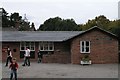
Stanton-by-Dale PO
On the published list for closure 2 Oct 07.
As of August 2008 - it struggles on: http://news.bbc.co.uk/1/hi/england/derbyshire/7576116.stm
Image: © David Lally
Taken: 6 Oct 2007
0.09 miles
9

Stanton-by-Dale, Derbys.
With the village crossroads behind the photographer, a view of some very substantial houses on Main Road as it leads away from the village towards School Lane and Quarry Hill, i.e. Eastwards towards Nottinghamshire.
Image: © David Hallam-Jones
Taken: 16 Feb 2013
0.12 miles
10
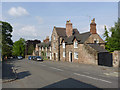
Cottages on Stanhope Street
An attractive range of cottages built in the local gritstone. The tall gabled cottage carries the street name and the date 1790 http://www.geograph.org.uk/photo/3489650. The range is Listed Grade II.
Image: © Alan Murray-Rust
Taken: 31 May 2013
0.13 miles