
IMAGES TAKEN NEAR TO
Godfrey Drive, ILKESTON, DE7 4HJ
Introduction
This page details the photographs taken nearby to Godfrey Drive, DE7 4HJ by members of the Geograph project.
The Geograph project started in 2005 with the aim of publishing, organising and preserving representative images for every square kilometre of Great Britain, Ireland and the Isle of Man.

There are currently over 7.5m images from over14,400 individuals and you can help contribute to the project by visiting https://www.geograph.org.uk
Image Map
Images are licensed for reuse under creativecommons.org/licenses/by-sa/2.0
Notes
- Clicking on the map will re-center to the selected point.
- The higher the marker number, the further away the image location is from the centre of the postcode.
Image Listing (32 Images Found)
Images are licensed for reuse under creativecommons.org/licenses/by-sa/2.0
Image
Details
Distance
1
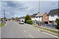
Godfrey Drive
This is the other end of the curving Godfrey Drive from my previous submission Image
Image: © Malcolm Neal
Taken: 29 Apr 2021
0.03 miles
2
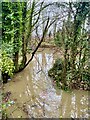
Flooded Woodland
The Nutbrook Canal has burst its banks and the floodwater is backing up against the road bridge embankment.
Image: © Jay Pea
Taken: 11 Jan 2023
0.07 miles
3
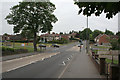
The entry to Kirk Hallam
At the top of the rise, Ladywood Road, is the ancient village of Kirk Hallam, which in the 1950s became the focus of an extensive housing development, initially to provide housing largely for the nearby Stanton ironworks, who contributed to the construction. This was the southern part of the development - turn left at the cross roads. A right turn takes you into the later, 1960s/70s development which was privately developed.
Image: © Alan Murray-Rust
Taken: 26 May 2010
0.07 miles
4
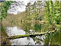
Lake near Little Hallam
A very picturesque lake at the side of the Nutbrook trail. For some reason untouched by the flood waters on the other side of the trail.
Image: © Jay Pea
Taken: 11 Jan 2023
0.09 miles
5
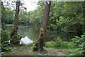
The Beauty Spot
This was originally part of the water supply for the town of Ilkeston. It later became an area known as The Beauty Spot, where boats could be hired, and the local youth could parade themselves. The beauty has rather disappeared today.
Image: © Alan Murray-Rust
Taken: 26 May 2010
0.09 miles
6
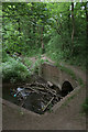
The Nut Brook
Entry to the culvert under Ladywood Road.
Image: © Alan Murray-Rust
Taken: 26 May 2010
0.09 miles
7

Nutbrook Trail notice
At the old railway bridge at Ladywood Road. As can be seen, The Nutbrook Trail is part of Sustrans route 67. I like the use of slightly unorthodox materials, old railway sleepers, to create a notice that is in harmony with its surroundings and decently robust.
Image: © Alan Murray-Rust
Taken: 26 May 2010
0.10 miles
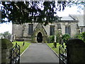
9
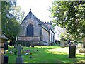
Kirk Hallam Church
It's always difficult to get a good angle from the gate or of the tower due to the proximity of the trees but the view above shows the church (dating mainly from the 14th and 15th centuries although its origin is Norman) from the eastern end.
Image: © Garth Newton
Taken: 9 Sep 2004
0.11 miles
10

Side of the trail
Signage and redundant pipes at the side of the trail adjacent to the road bridge.
Image: © Jay Pea
Taken: 11 Jan 2023
0.11 miles