
IMAGES TAKEN NEAR TO
Eaton Road, DERBY, DE74 2LQ
Introduction
This page details the photographs taken nearby to Eaton Road, DE74 2LQ by members of the Geograph project.
The Geograph project started in 2005 with the aim of publishing, organising and preserving representative images for every square kilometre of Great Britain, Ireland and the Isle of Man.

There are currently over 7.5m images from over14,400 individuals and you can help contribute to the project by visiting https://www.geograph.org.uk
Image Map
Images are licensed for reuse under creativecommons.org/licenses/by-sa/2.0
Notes
- Clicking on the map will re-center to the selected point.
- The higher the marker number, the further away the image location is from the centre of the postcode.
Image Listing (111 Images Found)
Images are licensed for reuse under creativecommons.org/licenses/by-sa/2.0
Image
Details
Distance
1
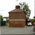
Dovecote off Delven Lane, Castle Donington
Early/mid 18th century, brick with diaper patterning, Listed Grade II. Originally related to Hall Farm.
Image: © Alan Murray-Rust
Taken: 18 Jun 2019
0.07 miles
2
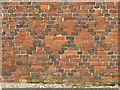
Dovecote off Delven Lane, Castle Donington
Well preserved diaper brickwork on the western face. See http://www.geograph.org.uk/photo/6188158 for location.
Image: © Alan Murray-Rust
Taken: 18 Jun 2019
0.07 miles
3
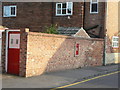
Rebuilt wall with post box
On Dovecote; a sympathetic rebuild although the bricks are not quite an exact match of style. The Edward VII post box has been retained Image
Image: © Alan Murray-Rust
Taken: 8 Aug 2009
0.07 miles
4
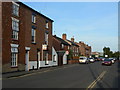
Mount Pleasant
Late 19th century development; Castle Donington Community College in the distance.
Image: © Alan Murray-Rust
Taken: 8 Aug 2009
0.08 miles
5
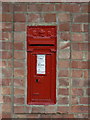
Edward VII wall box, Dovecote
Unusually this example simply carries the letters E R without the VII. This suggests that it could be a very early example, based on the simple substitution of E for V on a pattern from the previous reign. Box ref DE74 185.
Image: © Alan Murray-Rust
Taken: 8 Aug 2009
0.08 miles
6
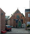
Former Methodist Sunday School
Mapped as 'Chapel warehouse', this was never a chapel. The Methodist congregation took over a former silk milk - the cross wing at the rear - and added this Gothic-style building in 1872 to form a Sunday School.
Image: © Alan Murray-Rust
Taken: 8 Aug 2009
0.09 miles
7
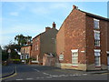
Dovecote, Castle Donington
There is no visible dovecote, but it lives on in the street name. This appears to be part of the early street layout.
Image: © Alan Murray-Rust
Taken: 8 Aug 2009
0.09 miles
8
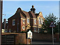
St Edward's School
Originally a Council-built school, now C. of E. voluntary aided. A fine example of terracotta decorative detailing, it dates from 1910.
Image: © Alan Murray-Rust
Taken: 8 Aug 2009
0.09 miles
9
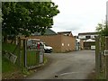
Castle Donington telephone exchange
Typical 1960s/70s exchange.
Image: © Alan Murray-Rust
Taken: 18 Jun 2019
0.09 miles
10
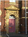
St Edward's School
Girls entrance, showing the ornate terracotta decoration.
Image: © Alan Murray-Rust
Taken: 8 Aug 2009
0.10 miles