
IMAGES TAKEN NEAR TO
Bosworth Road, DERBY, DE74 2JN
Introduction
This page details the photographs taken nearby to Bosworth Road, DE74 2JN by members of the Geograph project.
The Geograph project started in 2005 with the aim of publishing, organising and preserving representative images for every square kilometre of Great Britain, Ireland and the Isle of Man.

There are currently over 7.5m images from over14,400 individuals and you can help contribute to the project by visiting https://www.geograph.org.uk
Image Map
Images are licensed for reuse under creativecommons.org/licenses/by-sa/2.0
Notes
- Clicking on the map will re-center to the selected point.
- The higher the marker number, the further away the image location is from the centre of the postcode.
Image Listing (9 Images Found)
Images are licensed for reuse under creativecommons.org/licenses/by-sa/2.0
Image
Details
Distance
1
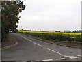
Paddock Close
Paddock Close is a residential street running north from Park Lane.
Image: © Andrew Tatlow
Taken: 6 May 2006
0.09 miles
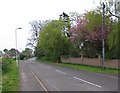
3
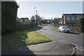
Looking up Park Lane
Another Castle Donington suburban road.
Image: © Malcolm Neal
Taken: 30 Jan 2019
0.17 miles
4

The junction of Park Lane with Shields Crescent
Image: © Graham Hogg
Taken: 8 Sep 2017
0.21 miles
5
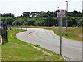
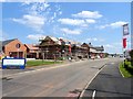
Castle Donington Relief Road
Opened in 2020 to take traffic away from the village centre and serve the new housing developments under construction in the area.
Image: © Ian Calderwood
Taken: 8 Aug 2020
0.21 miles
6
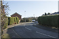
Shields Crescent
A suburban road in the village of Castle Donington.
Image: © Malcolm Neal
Taken: 30 Jan 2019
0.21 miles
8
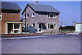
Cordwell Close, Castle Donington
Taken by my father 1966. In the distance are the cooling towers of the old Castle Donington power station
Image: © Arthur Holifield
Taken: Unknown
0.22 miles
9
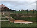
A new primary school
Some examples of reasonable planning. A new estate to the west of Castle Donington has an education facility built! The relief road surrounding the area has good, open drainage with flow reduction and balancing ponds.
Image: © David Lally
Taken: 12 Jan 2023
0.23 miles