
IMAGES TAKEN NEAR TO
Whatton Road, DERBY, DE74 2EZ
Introduction
This page details the photographs taken nearby to Whatton Road, DE74 2EZ by members of the Geograph project.
The Geograph project started in 2005 with the aim of publishing, organising and preserving representative images for every square kilometre of Great Britain, Ireland and the Isle of Man.

There are currently over 7.5m images from over14,400 individuals and you can help contribute to the project by visiting https://www.geograph.org.uk
Image Map
Images are licensed for reuse under creativecommons.org/licenses/by-sa/2.0
Notes
- Clicking on the map will re-center to the selected point.
- The higher the marker number, the further away the image location is from the centre of the postcode.
Image Listing (146 Images Found)
Images are licensed for reuse under creativecommons.org/licenses/by-sa/2.0
Image
Details
Distance
1
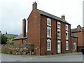
Lodge Farmhouse, 34 London Road, Kegworth
Late 18th century house with 19th century extensions. A feature of the house is the decorative stucco work on the lintels. Listed Grade II.
Image: © Alan Murray-Rust
Taken: 13 Jun 2018
0.08 miles
2
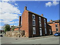
Lodge Farmhouse, Kegworth
Late eighteenth century house https://historicengland.org.uk/listing/the-list/list-entry/1084359?section=official-list-entry
Image: © Jonathan Thacker
Taken: 25 Apr 2023
0.08 miles
3
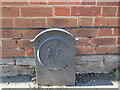
Stone outside Lodge Farmhouse
LCWW - Leicestershire County Water Works? Any ideas?
Image: © Jonathan Thacker
Taken: 25 Apr 2023
0.08 miles
4
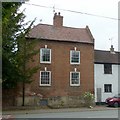
40 London Road, Kegworth (Friends Cottage)
The name derives from its former use as a Quaker (Society of Friends) meeting house. Mid 18th century, Listed Grade II.
Image: © Alan Murray-Rust
Taken: 13 Jun 2018
0.08 miles
5
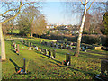
Kegworth Cemetery
View north across the village to Ratcliffe Power Station in the distance.
Image: © Trevor Rickard
Taken: 8 Jan 2011
0.09 miles
6
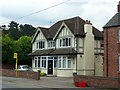
Former Britannia Inn, London Road, Kegworth
Now converted to apartments. The house on the right is newly built on the former car park.
Image: © Alan Murray-Rust
Taken: 13 Jun 2018
0.09 miles
7
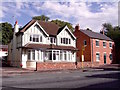
Britannia House
The Britannia Inn closed at the end of 2011 and has since been converted, to quote the planning application, "... to form two residential units in multiple occupation along with the erection of a new building in the car park to form two residential units in multiple occupation".
Image: © Ian Calderwood
Taken: 1 Sep 2015
0.09 miles
8
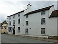
The Cedars, London Road, Kegworth
Late 18th century 3-bay house with extension of c.1840 to the right. Listed Grade II.
Image: © Alan Murray-Rust
Taken: 13 Jun 2018
0.10 miles
9

Old datestone
The wall above, and the buildings beyond, are modern so this probably came from whatever building stood here before the modern development.
Image: © Jonathan Thacker
Taken: 25 Apr 2023
0.10 miles
10
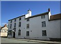
29 and 31 London Road, Kegworth
Late eighteenth century house with later extension https://historicengland.org.uk/listing/the-list/list-entry/1084387?section=official-list-entry
Image: © Jonathan Thacker
Taken: 25 Apr 2023
0.10 miles