
IMAGES TAKEN NEAR TO
Dragwell, DERBY, DE74 2EL
Introduction
This page details the photographs taken nearby to Dragwell, DE74 2EL by members of the Geograph project.
The Geograph project started in 2005 with the aim of publishing, organising and preserving representative images for every square kilometre of Great Britain, Ireland and the Isle of Man.

There are currently over 7.5m images from over14,400 individuals and you can help contribute to the project by visiting https://www.geograph.org.uk
Image Map
Images are licensed for reuse under creativecommons.org/licenses/by-sa/2.0
Notes
- Clicking on the map will re-center to the selected point.
- The higher the marker number, the further away the image location is from the centre of the postcode.
Image Listing (159 Images Found)
Images are licensed for reuse under creativecommons.org/licenses/by-sa/2.0
Image
Details
Distance
1

Dragwell, Kegworth
This is looking down from the top of Dragwell in 1978 with Ratcliffe Power Station in the distance. Bert Williams, the village butcher, later moved his shop to the Market Place; the premises are now occupied by a picture framing business.
Image: © Stephen McKay
Taken: Unknown
0.01 miles
2

Kegworth: down Dragwell
The sun was low in the sky before eight o'clock on a November morning and much of the village in shadow. The cooling towers of Ratcliffe on Soar Power Station are in the distance.
Image: © John Sutton
Taken: 2 Nov 2016
0.01 miles
3
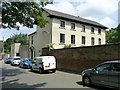
The Old Rectory, Kegworth
The main front from Nottingham Road. The house dates back to the mid 18th century but its current appearance is the result of rebuilding in the early-mid 19th century. Listed Grade II.
Image: © Alan Murray-Rust
Taken: 13 Jun 2018
0.04 miles
4
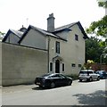
The Old Rectory, Kegworth
The Nottingham Road frontage with entrance door. The house dates back to the mid 18th century but its current appearance is the result of rebuilding in the early-mid 19th century. Listed Grade II.
Image: © Alan Murray-Rust
Taken: 13 Jun 2018
0.04 miles
5
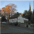
Kegworth: a November morning on Nottingham Road
The timbered house is Grade II listed and dated 1575 (though subsequently altered).
Image: © John Sutton
Taken: 2 Nov 2016
0.04 miles
6
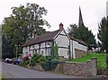
Cottage on Nottingham Road, Kegworth
A Grade II Listed Cottage built in 1575. The church is St. Andrew’s Parish Church, built in 1387.
Image: © Mat Fascione
Taken: 9 Sep 2007
0.04 miles
7

Small headstones in St Andrew's churchyard
Image: © Graham Hogg
Taken: 2 Jun 2020
0.04 miles
8

Church of St Andrew
Grade II* listed parish church dating from the 13th century and restored in 1860
Image: © Graham Hogg
Taken: 2 Jun 2020
0.04 miles
9
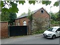
Former coach house and stable to the Old Rectory, Kegworth
Early 19th century, Listed Grade II.
Image: © Alan Murray-Rust
Taken: 13 Jun 2018
0.04 miles
