IMAGES TAKEN NEAR TO
Whatton Road, DERBY, DE74 2DT
Introduction
This page details the photographs taken nearby to Whatton Road, DE74 2DT by members of the Geograph project.
The Geograph project started in 2005 with the aim of publishing, organising and preserving representative images for every square kilometre of Great Britain, Ireland and the Isle of Man.

There are currently over 7.5m images from over14,400 individuals and you can help contribute to the project by visiting https://www.geograph.org.uk
Image Map
Images are licensed for reuse under creativecommons.org/licenses/by-sa/2.0
Notes
- Clicking on the map will re-center to the selected point.
- The higher the marker number, the further away the image location is from the centre of the postcode.
Image Listing (32 Images Found)
Images are licensed for reuse under creativecommons.org/licenses/by-sa/2.0
Image
Details
Distance
1
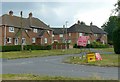
Ashby Road at the junction of Broadhill Road
The road closure is the result of the construction of the new village bypass.
Image: © Alan Murray-Rust
Taken: 13 Jun 2018
0.06 miles
2
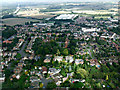
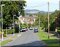
Kegworth from the air
On approach to East Midlands Airport on a flight from Glasgow.
Image: © Thomas Nugent
Taken: 8 Sep 2014
0.07 miles
4
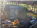
Kegworth Air Disaster Memorial
The air disaster occurred on the 8th of January 1989. British Midland Flight 92, a Boeing 737-400, crashed onto the embankment of the M1 motorway nearby when attempting an emergency landing at East Midlands Airport. Of the 126 people on board, 47 died and 74 sustained serious injuries. This memorial to 'those who died, those who were injured and those who took part in the rescue operation' lists the names of the 47 people who died and is surrounded by a small garden made of soil from the crash site.
http://www.kegworthvillage.com/show_page.php?id=2
http://en.wikipedia.org/wiki/Kegworth_air_disaster
Image: © Trevor Rickard
Taken: 8 Jan 2011
0.14 miles
5
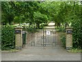
Kegworth Cemetery
The entrance on Ashby Road.
Image: © Alan Murray-Rust
Taken: 13 Jun 2018
0.14 miles
6
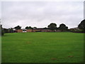
Playing fields, Kegworth Primary School
Image: © Eirian Evans
Taken: 5 Aug 2008
0.15 miles
7
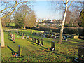
Kegworth Cemetery
View north across the village to Ratcliffe Power Station in the distance.
Image: © Trevor Rickard
Taken: 8 Jan 2011
0.15 miles
8
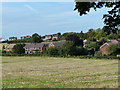
Houses on the edge of Kegworth
Looking northwest from Whatton Road.
Image: © Mat Fascione
Taken: 26 Sep 2013
0.15 miles