IMAGES TAKEN NEAR TO
Jawbone Lane, DERBY, DE73 8HN
Introduction
This page details the photographs taken nearby to Jawbone Lane, DE73 8HN by members of the Geograph project.
The Geograph project started in 2005 with the aim of publishing, organising and preserving representative images for every square kilometre of Great Britain, Ireland and the Isle of Man.

There are currently over 7.5m images from over14,400 individuals and you can help contribute to the project by visiting https://www.geograph.org.uk
Image Map
Images are licensed for reuse under creativecommons.org/licenses/by-sa/2.0
Notes
- Clicking on the map will re-center to the selected point.
- The higher the marker number, the further away the image location is from the centre of the postcode.
Image Listing (7 Images Found)
Images are licensed for reuse under creativecommons.org/licenses/by-sa/2.0
Image
Details
Distance
1
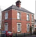
Turnbarrel House
The carving above the door still says "CONSTABULARY".
Image: © Ian Calderwood
Taken: 10 Apr 2010
0.18 miles
4
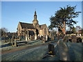
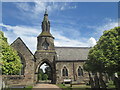
Melbourne Cemetery, Pack Horse Road, King's Newton
Grade II listed chapel
Image: © Tim Heaton
Taken: 14 Jan 2012
0.21 miles
5
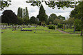
Melbourne Cemetery
Like all village cemeteries, this is immaculately cared for and seems to have lots of space for future burials, which is not always the case, especially in larger towns and cities.
Image: © Malcolm Neal
Taken: 7 Aug 2017
0.21 miles
6
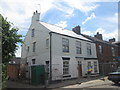
Building work beside Station Road, Melbourne
I think this used to be the Railway Hotel and, at one time according to Old Maps, The Clifton Arms Inn.
Image: © John Slater
Taken: 6 Jul 2014
0.21 miles