IMAGES TAKEN NEAR TO
Slade Lane, DERBY, DE73 8AG
Introduction
This page details the photographs taken nearby to Slade Lane, DE73 8AG by members of the Geograph project.
The Geograph project started in 2005 with the aim of publishing, organising and preserving representative images for every square kilometre of Great Britain, Ireland and the Isle of Man.

There are currently over 7.5m images from over14,400 individuals and you can help contribute to the project by visiting https://www.geograph.org.uk
Image Map
Images are licensed for reuse under creativecommons.org/licenses/by-sa/2.0
Notes
- Clicking on the map will re-center to the selected point.
- The higher the marker number, the further away the image location is from the centre of the postcode.
Image Listing (24 Images Found)
Images are licensed for reuse under creativecommons.org/licenses/by-sa/2.0
Image
Details
Distance
1

Former railway line towards Tonge
Now part of the 13 mile Cloud Trail from Worthington to Derby following a former railway line. National Cycle route 6 also follows the trail at this point.
Image: © Andrew Tatlow
Taken: 30 Aug 2020
0.02 miles
2
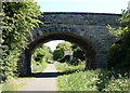
Slade Lane bridge crossing the Cloud Trail at Wilson
The Cloud Trail is a 13 mile traffic free cycle route that runs from Derby to Worthington along National Cycle Network route number 6. The route begins in the centre of Derby and ends at the Cloud Quarry in Worthington. This section of the Cloud Trail is following the former Derby to Ashby-de-la Zouch Railway Line.
Image: © Mat Fascione
Taken: 25 May 2020
0.02 miles
4
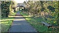
The Cloud Trail at Slade Lane, Wilson
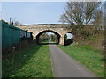
The former Derby - Ashby railway line.
Image: © Christine Johnstone
Taken: 4 Nov 2020
0.03 miles
5
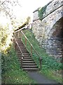
This way to Slade Lane and Wilson
Steps up from the Cloud Trail.
Image: © Christine Johnstone
Taken: 4 Nov 2020
0.04 miles
6

Long shadows on a bare field, north-east of Wilson
Early afternoon, early November.
Image: © Christine Johnstone
Taken: 4 Nov 2020
0.10 miles
7
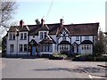
Loudoun House and Hill View
The house on the left is Loudoun House. It was, originally, a pub called "The Rat and Ferret", which was later renamed "The Loudoun Arms", after the countess of Loudoun who married Lord Donington, the local landowner. In the 1920s, it became a shop called "Dow's", before finally being converted to a house.
Image: © Ian Calderwood
Taken: 1 Apr 2012
0.11 miles
8
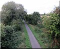
Former railway line towards Derby from Slade Lane
Now part of the 13 mile Cloud Trail from Worthington to Derby following a former railway line. National Cycle route 6 also follows the trail at this point.
Image: © Andrew Tatlow
Taken: 30 Aug 2020
0.13 miles
9
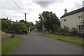
Wilson Village
This tiny and very quiet village has, for me, a very unusual name - being called Wilson. Whether this is after a particular person I have no knowledge.
Image: © Malcolm Neal
Taken: 7 Aug 2017
0.14 miles