1
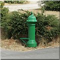
Ticknall water tap, Chapel Lane
One of 21 public water taps installed in the village in 1914. Water pumped up from a well by wind power was stored in a reservoir and fed the 'self-closing fountains' by gravity. Except for houses with their own private wells or springs, this was the only water source for the village until 1962. This particular tap remained the only water supply for the Methodist Chapel behind until the 1914 reservoir was abandoned in 1992. Sixteen of the water taps survive, but this is the only one that still works.
Image: © Christine Johnstone
Taken: 15 Sep 2020
0.01 miles
2
Water fountain outside the Methodist Chapel, Ticknall
The fact that this fountain still has a water supply is highlighted by the irrigated line of green grass among the parched grass resulting from the heatwave of June/July 2018. This fountain retains a supply because the Chapel did not get its own mains supply until 1992, so this fountain was connected to the mains when the other fountains went out of use in the 1960s when the village got its main water supply.
Image: © Alan Murray-Rust
Taken: 24 Jul 2018
0.02 miles
3
Methodist Chapel, Ticknall
A large chapel, built in 1815 when the village was expanding due to the extensive lime industry. The interior is still largely original. Listed Grade II.
Image: © Alan Murray-Rust
Taken: 24 Jul 2018
0.02 miles
4
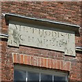
Ticknall Methodist Church, datestone
See http://www.geograph.org.uk/photo/5860661 for location.
Image: © Alan Murray-Rust
Taken: 24 Jul 2018
0.02 miles
5
Methodist Chapel, Chapel Street, Ticknall
Built in 1815 and Grade 2 listed.
Image: © Christine Johnstone
Taken: 12 Sep 2020
0.02 miles
6
Methodist Church
Methodist Church, Ticknall. Built in 1815 according to the stone inscription.
Image: © Phil Myott
Taken: 9 Oct 2006
0.03 miles
7
Ticknall Vineyard
Small vineyard right in the centre of the village.
http://www.histman.co.uk/ticknall-cms/?Tourism:Vineyard
Image: © Trevor Rickard
Taken: 31 Jul 2009
0.03 miles
8
57 & 59 Main Street, Ticknall
A pair of early 18th century cottages, Listed Grade II. Note also the water pump in the foreground, see http://www.geograph.org.uk/photo/5860660.
Image: © Alan Murray-Rust
Taken: 24 Jul 2018
0.06 miles
9
Ticknall water tap, north side, Main Street
Almost opposite the Wheel Inn. One of 21 public water taps installed in the village in 1914. Water pumped up from a well by wind power was stored in a reservoir and fed the 'self-closing fountains' by gravity. Except for houses with their own private wells or springs, this was the only water source for the village until 1962. Sixteen of the water taps survive, but only the one on Chapel Street still works.
Image: © Christine Johnstone
Taken: 1 Nov 2020
0.06 miles
10
Water fountain at 57 Main Street, Ticknall
See http://www.geograph.org.uk/photo/5860658 for location.
Image: © Alan Murray-Rust
Taken: 24 Jul 2018
0.06 miles


