
IMAGES TAKEN NEAR TO
Ashby Road, DERBY, DE73 7JJ
Introduction
This page details the photographs taken nearby to Ashby Road, DE73 7JJ by members of the Geograph project.
The Geograph project started in 2005 with the aim of publishing, organising and preserving representative images for every square kilometre of Great Britain, Ireland and the Isle of Man.

There are currently over 7.5m images from over14,400 individuals and you can help contribute to the project by visiting https://www.geograph.org.uk
Image Map
Images are licensed for reuse under creativecommons.org/licenses/by-sa/2.0
Notes
- Clicking on the map will re-center to the selected point.
- The higher the marker number, the further away the image location is from the centre of the postcode.
Image Listing (16 Images Found)
Images are licensed for reuse under creativecommons.org/licenses/by-sa/2.0
Image
Details
Distance
1
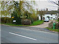
The Green at Ticknall
This old house at the end of Ticknall looks like it could have been a former pub.
Image: © John Poyser
Taken: 3 Apr 2007
0.02 miles
2
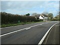
Ticknall tap, west side, Ashby Road
One of 21 public water taps installed in the village in 1914. Water pumped up from a well by wind power was stored in a reservoir and fed the 'self-closing fountains' by gravity. Except for houses with their own private wells or springs, this was the only water source for the village until 1962. Sixteen of the water taps survive, but only the one on Chapel Street still works.
Image: © Christine Johnstone
Taken: 1 Nov 2020
0.02 miles
3
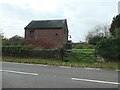
The Forge, off Ashby Road, Ticknall
Opposite Basford's Hill Farm.
Image: © Christine Johnstone
Taken: 1 Nov 2020
0.04 miles
4
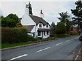
White cottage
One of the last cottages in Ticknall at the side of the B5006.
Image: © John Poyser
Taken: 3 Apr 2007
0.05 miles
5
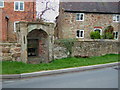
Spring Cottage
One of the many old cottages in Ticknall, this one has one of the several springs or wells outside.
Image: © John Poyser
Taken: 3 Apr 2007
0.10 miles
6
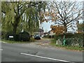
Ticknall tap, at the Green
One of 21 public water taps installed in the village in 1914. Water pumped up from a well by wind power was stored in a reservoir and fed the 'self-closing fountains' by gravity. Except for houses with their own private wells or springs, this was the only water source for the village until 1962. Sixteen of the water taps survive, but only the one on Chapel Street still works.
Image: © Christine Johnstone
Taken: 1 Nov 2020
0.10 miles
7
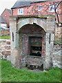
A spring at Ticknall
One of several in the village, these were used for the supply of water to the cottages.
Image: © John Poyser
Taken: 3 Apr 2007
0.10 miles
8
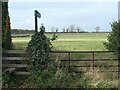
Public footpath to Middle Lodge
Heading south-east from the Ashby Road at the southern end of Ticknall.
Image: © Christine Johnstone
Taken: 1 Nov 2020
0.11 miles
9
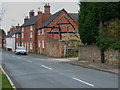
Cruck
The gable end of this cottage clearly shows the original size of the building, probably a small cruck frame thatched cottage.
Image: © John Poyser
Taken: 3 Apr 2007
0.13 miles
10
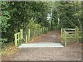
Cattle grid on the Ticknall tramway
The tramway opened in 1802, to carry lime from Ticknall to the Ashby Canal. It officially closed in 1915, and was resurfaced by the National Trust in 2014. This section is part of the National Trust's tramway trail.
Image: © Christine Johnstone
Taken: 1 Nov 2020
0.15 miles