
IMAGES TAKEN NEAR TO
Wilne Mill, DERBY, DE72 3QJ
Introduction
This page details the photographs taken nearby to Wilne Mill, DE72 3QJ by members of the Geograph project.
The Geograph project started in 2005 with the aim of publishing, organising and preserving representative images for every square kilometre of Great Britain, Ireland and the Isle of Man.

There are currently over 7.5m images from over14,400 individuals and you can help contribute to the project by visiting https://www.geograph.org.uk
Image Map
Images are licensed for reuse under creativecommons.org/licenses/by-sa/2.0
Notes
- Clicking on the map will re-center to the selected point.
- The higher the marker number, the further away the image location is from the centre of the postcode.
Image Listing (64 Images Found)
Images are licensed for reuse under creativecommons.org/licenses/by-sa/2.0
Image
Details
Distance
1
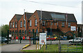
Chemring Defence, Church Wilne
A pyrotechnics firm in a former two storey cotton mill that was built in 1924 on the site of the 18th century cotton mill that was destroyed by fire in 1917. The site has a long history and was previously used for lead rolling, fulling and corn grinding. The firm is now apparently known as PW Defence.
Image: © Chris Allen
Taken: 18 May 2013
0.01 miles
2
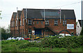
Chemring Defence, Church Wilne
A pyrotechnics firm in a former two storey cotton mill that was built in 1924 on the site of the 18th century cotton mill that was destroyed by fire in 1917. The site has a long history and was previously used for lead rolling, fulling and corn grinding. It is now apparently PW defence.
Image: © Chris Allen
Taken: 18 May 2013
0.01 miles
3

Chemring Defence
A pyrotechnics firm in a former two storey cotton mill that was built in 1924 on the site of the 18th century cotton mill that was destroyed by fire in 1917. The site has a long history and was previously used for lead rolling, fulling and corn grinding. Despite the site's history it is, to my eye, rather nondescript and this is about the only angle.
Image: © Chris Allen
Taken: 18 May 2013
0.01 miles
4

Works at Church Wilne
Perhaps a surprising place to find a high-tech company like Chemring Defence, but this fenced-off site usefully employs the former Wilne Mill buildings. The large mill here was originally used for corn milling, lead rolling and slitting, and cotton milling.
http://www.chemring.co.uk/
Image: © Trevor Rickard
Taken: 2 Jan 2011
0.01 miles
5

Aqueduct over the Derwent
I have no idea whether this has anything to do with the works on the north bank here, or if it is simply a sewer pipe from Draycott to the works in SK4530.
Image: © David Lally
Taken: 12 Oct 2008
0.08 miles
6
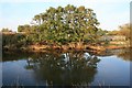
Alders on the bank on the Derwent
The trees are within the grounds of the factory on the north bank of the river here.
Image: © David Lally
Taken: 12 Oct 2008
0.09 miles
7
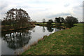
The River Derwent Between Church and Great Wilne
Church Wilne and Great Wilne (the former now consisting of just a church) while sharing a name are on opposite sides of the river.
While it is now a couple of weeks since we have had any significant precipitation and despite looking calm and serene, the river's flow was, on close inspection, very swift and strong.
Image: © David Lally
Taken: 28 Feb 2009
0.10 miles
8

Small Island in the Derwent
Colonised by grasses and willows.
Image: © David Lally
Taken: 12 Oct 2008
0.13 miles

10

Himalayan Balsam by the River Derwent
The Derwent has patches of this invasive plant along nearly its entire length.
Image: © David Lally
Taken: 12 Oct 2008
0.15 miles