
IMAGES TAKEN NEAR TO
Wilne Road, DERBY, DE72 3QG
Introduction
This page details the photographs taken nearby to Wilne Road, DE72 3QG by members of the Geograph project.
The Geograph project started in 2005 with the aim of publishing, organising and preserving representative images for every square kilometre of Great Britain, Ireland and the Isle of Man.

There are currently over 7.5m images from over14,400 individuals and you can help contribute to the project by visiting https://www.geograph.org.uk
Image Map
Images are licensed for reuse under creativecommons.org/licenses/by-sa/2.0
Notes
- Clicking on the map will re-center to the selected point.
- The higher the marker number, the further away the image location is from the centre of the postcode.
Image Listing (36 Images Found)
Images are licensed for reuse under creativecommons.org/licenses/by-sa/2.0
Image
Details
Distance
1

Riverside footpath near Draycott
Of note is the fact that the main notice has been put up by the Environment Agency rather than the local authority. The path runs along the flood defence bank of the river Derwent.
Image: © Alan Murray-Rust
Taken: 11 Aug 2017
0.02 miles
2

Ridge and furrow near Draycott
A well preserved example, now used as paddocks.
Image: © Alan Murray-Rust
Taken: 11 Aug 2017
0.03 miles
3

Cableway to river recording station at Draycott
This is a link between the river recording station at Draycott and the south bank of the river Derwent.
Image: © Richard Green
Taken: 7 Mar 2011
0.04 miles
4

Site of ferry across river Derwent at Draycott
There used to be a ferry across the river Derwent at this point, reached by a footpath from the hamlet of Ambaston, about 1 mile away behind the photographer. The house painted white on the right of the picture is still called Ferry House.
Image: © Richard Green
Taken: 7 Mar 2011
0.04 miles
5

Public footpath south of Draycott
Leading to the left bank of the River Derwent.
Image: © Richard Vince
Taken: 21 Dec 2019
0.05 miles
6
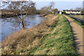
The River Derwent - South of Draycott
A bank protects the surrounding fields (and Draycott) from flooding from the river.
Just behind the photographer's position is a Severn Trent Water river inlet and associated building.
Image: © David Lally
Taken: 29 Dec 2007
0.05 miles
7

Road south of Draycott
Traversing a reverse curve on its way to join the left bank of the River Derwent.
Image: © Richard Vince
Taken: 21 Dec 2019
0.06 miles
8

Water intake facility at Draycott
Looking east along the River Derwent levee to the Severn Trent waterworks which extracts water from the river here. In the distance on the right is Ratcliffe Power Station.
Image: © Trevor Rickard
Taken: 2 Jan 2011
0.06 miles
9

River Derwent near Draycott
On the right is the intake to Draycott Water Intake plant http://www.geograph.org.uk/photo/5501175
Image: © Alan Murray-Rust
Taken: 11 Aug 2017
0.06 miles
10

River recording station at Draycott
This is a "River Analysis and Height Recording Station" on the river Derwent at Draycott. There is a cableway link to the south bank.
Image: © Richard Green
Taken: 7 Mar 2011
0.06 miles