
IMAGES TAKEN NEAR TO
Wilne Road, DERBY, DE72 3NG
Introduction
This page details the photographs taken nearby to Wilne Road, DE72 3NG by members of the Geograph project.
The Geograph project started in 2005 with the aim of publishing, organising and preserving representative images for every square kilometre of Great Britain, Ireland and the Isle of Man.

There are currently over 7.5m images from over14,400 individuals and you can help contribute to the project by visiting https://www.geograph.org.uk
Image Map
Images are licensed for reuse under creativecommons.org/licenses/by-sa/2.0
Notes
- Clicking on the map will re-center to the selected point.
- The higher the marker number, the further away the image location is from the centre of the postcode.
Image Listing (75 Images Found)
Images are licensed for reuse under creativecommons.org/licenses/by-sa/2.0
Image
Details
Distance
1

Draycott Methodist Church
Datestone of the original 1865 chapel. http://www.geograph.org.uk/photo/5499285
Image: © Alan Murray-Rust
Taken: 11 Aug 2017
0.02 miles
2
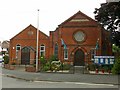
Draycott Methodist Church
The original chapel of 1865 http://www.geograph.org.uk/photo/5499292 to the left became a Sunday School when the new, larger chapel was built in 1897. It now serves as a church hall. When the different Methodist groups amalgamated, clearly the Draycott congregation centred on the Primitive chapel, rather than the Wesleyan chapel which is now the Anglican Parish Church.
Image: © Alan Murray-Rust
Taken: 11 Aug 2017
0.02 miles
3

Draycott Methodist Church, South Street, Draycott
The chapel on the left was built in 1869, while the main body of the church was built in 1897.
Image: © Richard Green
Taken: 8 Jun 2011
0.02 miles
4
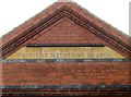
Draycott Methodist Church
Inscription in the gable of the new church, built 1897. http://www.geograph.org.uk/photo/5499285
Image: © Alan Murray-Rust
Taken: 11 Aug 2017
0.03 miles
5

Cedars Farmhouse, Market Street, Draycott
A fine late 18th century farmhouse, the front being largely unaltered. Listed Grade II.
Image: © Alan Murray-Rust
Taken: 11 Aug 2017
0.03 miles

7
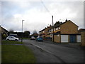
Holly Close, Draycott
Off Market Street.
Image: © Richard Vince
Taken: 21 Dec 2019
0.06 miles
8

Road south of Draycott
Traversing a reverse curve on its way to join the left bank of the River Derwent.
Image: © Richard Vince
Taken: 21 Dec 2019
0.06 miles
9
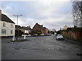
West end of South Street, Draycott
Seen from Market Street.
Image: © Richard Vince
Taken: 21 Dec 2019
0.07 miles
10

Rose and Crown, Draycott
This inn is in Market Street, Draycott.
Image: © Richard Green
Taken: 8 Jun 2011
0.07 miles