1
28 Brook Road, Borrowash
Formerly known as Rock House. Early 19th century Regency style house in stucco with low pitch hipped slate roof typical of the period. Listed Grade II.
Image: © Alan Murray-Rust
Taken: 11 Aug 2017
0.10 miles
2
Vegetation clearance on the Derby Canal
A "Working Wednesdays" work party has been busy clearing regrowing trees along the towpath and clearing the canal channel.
Image: © Ian Calderwood
Taken: 30 Nov 2016
0.11 miles
3
Derby to Nottingham railway line from the B5010
Image: © Tim Heaton
Taken: 2 Sep 2012
0.12 miles
4
Borrowash 1st railway station (site), Derbyshire
Opened in 1839 by the Midland Counties Railway, soon to become the Midland Railway, on the line from Derby to Nottingham and Leicester, this station was closed in 1871 when it was replaced by a more spacious one slightly closer to Derby.
View west at the surviving building, now a private residence. The platforms have long since been removed.
Image: © Nigel Thompson
Taken: 1 Apr 2022
0.12 miles
5
Derby and Sandiacre Canal
The canal here is disused and the water covered with algae. The old towpath is now part of national Cycle Route 6, and the metal fence marks the edge of the Nottingham to Derby rail line.
Image: © Oxymoron
Taken: 27 Oct 2008
0.12 miles
6
The Ock Brook
From the bridge on Brook Road.
Image: © Alan Murray-Rust
Taken: 12 Jun 2018
0.13 miles
7
Derby Canal, Borrowash
Some restoration work has taken place here to the east of Station Road at Borrowash. Further along Borrowash Bottom Lock has also been restored. This is a magnificent effort but there is an enormous amount of work to do if the full 14 miles of the canal from Sandiacre to Swarkestone are ever to be restored.
Image: © Stephen McKay
Taken: 27 Jan 2023
0.13 miles
8
Derby Canal at Station Road, Borrowash
To the eastern side of the road the canal has not been filled in, although heavily overgrown, although the towpath has been developed as a footpath and cycle route.
Image: © Alan Murray-Rust
Taken: 11 Aug 2017
0.13 miles
9
Tributary of the Derwent
This little stream runs down into the Derwent a few hundreds of metres away.
Image: © Oxymoron
Taken: 27 Oct 2008
0.15 miles
10
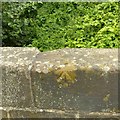
Rivet bench mark, Barnes's Bridge, Borrowash
See http://www.geograph.org.uk/photo/5499202 for location.
Image: © Alan Murray-Rust
Taken: 11 Aug 2017
0.16 miles


