IMAGES TAKEN NEAR TO
Derby Road, DERBY, DE72 3JW
Introduction
This page details the photographs taken nearby to Derby Road, DE72 3JW by members of the Geograph project.
The Geograph project started in 2005 with the aim of publishing, organising and preserving representative images for every square kilometre of Great Britain, Ireland and the Isle of Man.

There are currently over 7.5m images from over14,400 individuals and you can help contribute to the project by visiting https://www.geograph.org.uk
Image Map
Images are licensed for reuse under creativecommons.org/licenses/by-sa/2.0
Notes
- Clicking on the map will re-center to the selected point.
- The higher the marker number, the further away the image location is from the centre of the postcode.
Image Listing (36 Images Found)
Images are licensed for reuse under creativecommons.org/licenses/by-sa/2.0
Image
Details
Distance
1
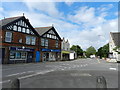
Shops on Derby Road
Opposite Victoria Avenue.
Image: © Peter Barr
Taken: 23 Jun 2012
0.00 miles
2
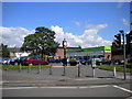
Borrowash Clock
This small clock tower, next to the car park off Victoria Avenue in Borrowash, was erected to commemorate the Queen's golden jubilee in 2002. The Co-operative food shop was formerly a Somerfield (see Image).
Image: © Richard Vince
Taken: 7 Jul 2012
0.02 miles
3
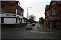
Station Road, Borrowash
There's no longer a station in Borrowash. The line into Derby from St Pancras and Nottingham still runs through the village about 300 metres from here.
Image: © David Lally
Taken: 31 Jan 2010
0.02 miles
4
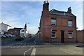
The ex-Noah's Ark
Former cross-road pub in Borrowash. Previously: Image
Image: © David Lally
Taken: 30 Nov 2016
0.02 miles
5
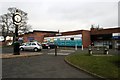
Somerfield, Borrowash
Remains open after the Co-op take-over. Will probably be re-branded during 2010.
On the left is a clock commemorating Queen Elizabeth's Golden Jubilee in 2002.
Image: © David Lally
Taken: 31 Jan 2010
0.04 miles
6
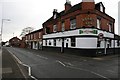
Noah's Ark
A pub in the centre of Borrowash village. At the corner of Nottingham Road and Station Road.
Image: © David Lally
Taken: 31 Jan 2010
0.04 miles
7
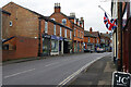
Nottingham Road, Borrowash
A series of three large villages sits on the A6005 road between Long Eaton and Derby: Breaston, Draycott and Borrowash. Borrowash is the most westerly of them. They are all solid, red-brick, workaday places, typical of the East Midlands. This view is looking towards Derby in the centre of Borrowash.
Image: © Stephen McKay
Taken: 27 Jan 2023
0.05 miles
8
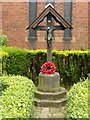
World War 1 memorial, St Stephen's Church, Borrowash
Timber cross and bronze crucifix by Alfred Mowbray & Co of Oxford on octagonal stone base by Samuel Hodgkinson of Borrowash, erected in 1920. Listed Grade II. Unusually there is no supplementary commemoration relating to the Second World War.
See http://www.geograph.org.uk/photo/5498916 for location.
Image: © Alan Murray-Rust
Taken: 11 Aug 2017
0.06 miles
9

Dovecote Drive
A very quiet cul-de-sac in Borrowash but very close to Nottingham Road.
Image: © Malcolm Neal
Taken: 6 Jul 2017
0.06 miles