
IMAGES TAKEN NEAR TO
Albert Road, DERBY, DE72 3DL
Introduction
This page details the photographs taken nearby to Albert Road, DE72 3DL by members of the Geograph project.
The Geograph project started in 2005 with the aim of publishing, organising and preserving representative images for every square kilometre of Great Britain, Ireland and the Isle of Man.

There are currently over 7.5m images from over14,400 individuals and you can help contribute to the project by visiting https://www.geograph.org.uk
Image Map
Images are licensed for reuse under creativecommons.org/licenses/by-sa/2.0
Notes
- Clicking on the map will re-center to the selected point.
- The higher the marker number, the further away the image location is from the centre of the postcode.
Image Listing (43 Images Found)
Images are licensed for reuse under creativecommons.org/licenses/by-sa/2.0
Image
Details
Distance
1
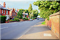
Station Road, Draycott
Leaving the village toward Breaston.
Image: © David Lally
Taken: 13 Jun 2008
0.09 miles
2
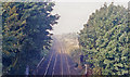
Site of Draycott & Breaston station, 1991
View westward, towards Derby: ex-Midland London - Leicester - Derby etc. main line. The station - actually behind the camera - was closed 14/2/66. (Cf. Image]).
Image: © Ben Brooksbank
Taken: 22 Oct 1991
0.10 miles
3
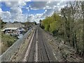
Draycott & Breaston railway station (site), Derbyshire
Opened as "Draycott" in 1852 by the Midland Railway on the lines from Derby to Nottingham and Leicester, this station closed in 1966.
View south east towards Sawley, Nottingham and Leicester. As Sawley station was so close (about a mile away - see Image), that closed in 1930. The name of this station became "Draycott and Breaston" in 1939.
Image: © Nigel Thompson
Taken: 1 Apr 2022
0.12 miles
4
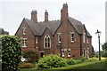
Ferrestone House, Draycott
Built in 1875 as Draycott Vicarage. Sold by the Diocese of Derby in 1961 when the parish of Draycott was merged with Breaston. Then renamed Ferrestone House it was the home of Mr. Jack Goss, the manager of F.W. Woolworth in Long Eaton.
Image: © Andrew Abbott
Taken: 16 Jun 2019
0.14 miles
5
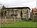
Valve house at Breaston
This little building was constructed by the Derwent Valley Water Board in about 1915. It houses control gear for the Derwent Valley aqueduct, which conveys water from the Howden and Derwent reservoirs in the Peak District to Derby and Leicester.
Image: © Richard Green
Taken: 16 Feb 2011
0.14 miles
6

The Olympian, Draycott
Fine looking pub on the eastern edge of the village.
The clock tower is on Victoria Mill.
Image: © David Lally
Taken: 13 Jun 2008
0.17 miles
7

The Olympic Hotel, Draycott
Originally the Drycott Hotel. Built ca. 1890.
Image: © Andrew Abbott
Taken: 16 Jun 2019
0.18 miles
8
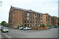
Victoria Mill, Draycott
Magnificent former textile mill that dominates this end of the small town of Draycott. The mill to the first stair tower at the other end had been converted to dwellings but perhaps 3/4 of the building was still empty. Recent Streetview images show that the whole mill is now converted to accommodation.
Image: © Chris Allen
Taken: 18 May 2013
0.18 miles
9
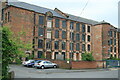
Victoria Mill, Draycott
Magnificent former textile mill that dominates this end of the small town of Draycott. The mill to the first stair tower at the other end had been converted to dwellings but perhaps 3/4 of the building was still empty.
Recent Streetview images show that the whole mill is now converted to accommodation.
Image: © Chris Allen
Taken: 18 May 2013
0.19 miles
10
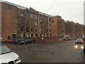
Victoria Mill now all converted
The last time I was round here only about a third of the building (the end nearest the main road and clock tower) was apartments http://www.geograph.org.uk/photo/843710 and http://www.geograph.org.uk/photo/843708 . This is the other end and all is occupied.
Image: © David Lally
Taken: 19 Jun 2016
0.19 miles