IMAGES TAKEN NEAR TO
Dale Close, DERBY, DE72 3AZ
Introduction
This page details the photographs taken nearby to Dale Close, DE72 3AZ by members of the Geograph project.
The Geograph project started in 2005 with the aim of publishing, organising and preserving representative images for every square kilometre of Great Britain, Ireland and the Isle of Man.

There are currently over 7.5m images from over14,400 individuals and you can help contribute to the project by visiting https://www.geograph.org.uk
Image Map
Images are licensed for reuse under creativecommons.org/licenses/by-sa/2.0
Notes
- Clicking on the map will re-center to the selected point.
- The higher the marker number, the further away the image location is from the centre of the postcode.
Image Listing (87 Images Found)
Images are licensed for reuse under creativecommons.org/licenses/by-sa/2.0
Image
Details
Distance
2
The Navigation at Breaston
The Navigation pub at Breaston stands beside the route of the Derby and Sandiacre Canal. It is almost 40 years since the last boat came along here but plans to reopen the canal may once again see brightly painted narrow boats calling here for refreshment.
Image: © Mike Bardill
Taken: 5 Feb 2006
0.09 miles
4
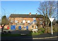
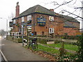
The Navigation, Breaston
Parts of the building look as if they are more or less contemporary with the (former) Derby Canal alongside which it is situated.
Image: © Alan Murray-Rust
Taken: 7 Jan 2018
0.10 miles
5
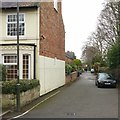
Ward's Lane, Breaston
One of the old lanes of the village, being shown on the first series 1" OS maps. There is a bench mark http://www.geograph.org.uk/photo/5642235 on the stone wall to the left of the picture.
Image: © Alan Murray-Rust
Taken: 1 Jan 2018
0.10 miles
6
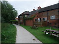
Cycle Route 6 entering Breaston behind 'The Navigation'
The name of the pub reflects its position on the former derby-Sandiacre Canal
Image: © Tim Heaton
Taken: 2 Sep 2012
0.10 miles
8

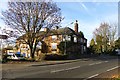
Dog-walker on Former Canal Route
Path, cycleway and route of the former Derby and Sandiacre Canal, pictured here close to the Navigation Inn at Breaston. Plans remain afoot to regenerate the 14.5 mile-long canal which originally opened to traffic in 1796. Coal was the main cargo to be transported along the route which finally closed in 1964 following a typically long and painful decline.
Image: © Jonathan Clitheroe
Taken: 29 Dec 2013
0.11 miles
9

Derby Canal path, Breaston
The tables form the beer garden of The Navigation.
Image: © Alan Murray-Rust
Taken: 7 Jan 2018
0.11 miles