
IMAGES TAKEN NEAR TO
Cheal Close, DERBY, DE72 2DY
Introduction
This page details the photographs taken nearby to Cheal Close, DE72 2DY by members of the Geograph project.
The Geograph project started in 2005 with the aim of publishing, organising and preserving representative images for every square kilometre of Great Britain, Ireland and the Isle of Man.

There are currently over 7.5m images from over14,400 individuals and you can help contribute to the project by visiting https://www.geograph.org.uk
Image Map
Images are licensed for reuse under creativecommons.org/licenses/by-sa/2.0
Notes
- Clicking on the map will re-center to the selected point.
- The higher the marker number, the further away the image location is from the centre of the postcode.
Image Listing (22 Images Found)
Images are licensed for reuse under creativecommons.org/licenses/by-sa/2.0
Image
Details
Distance
1

Site of the Grove Hospital
The hospital has been gone a few years now, but this is where it was http://www.geograph.org.uk/photo/5284.
Image: © David Lally
Taken: 11 Jun 2009
0.02 miles
2
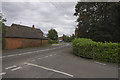
Shardlow village
Shardlow village is somewhat of a ribbon development with a few houses on both sides of the road but very few houses away from it and relatively few side streets.
Image: © Malcolm Neal
Taken: 7 Aug 2017
0.05 miles
3

Bus Shelter and Modern Dwellings in Shardlow
This is the western end of the village. Moor Farm is partially visible on the right of picture.
Image: © Jonathan Clitheroe
Taken: 14 Apr 2013
0.05 miles
4
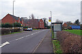
London Road, Shardlow
At one time this was a stretch of the A6 but Shardlow has now been by-passed and it has been downgraded to the B5010. The 'London Road' name reflects its old importance. The bus stops here are served by the Skylink Derby service which runs between Derby and Leicester via East Midlands Airport. It runs on a 24-hours 7 days a week basis meaning that Shardlow and the other villages on the route have an astonishingly good bus service for a rural area.
Image: © Stephen McKay
Taken: 27 Jan 2023
0.06 miles

6

Bench mark, Moor Farm, Shardlow
See http://www.geograph.org.uk/photo/5679585 for location.
Image: © Alan Murray-Rust
Taken: 11 Feb 2018
0.07 miles

8

Old Milepost by the B5010, London Road, Shardlow,
Derby iron bobbin by the B5010 (was A6), in parish of Shardlow and Great Wilne (South Derbyshire District), London Road; North West edge of Shardlow, by Shardlow Business Park entrance, on grass verge, South West side of road.
Lost since August 2008 (Streetview)
Inscription reads:-
: DERBY / 6 / MILES : : LONDON / 120 / MILES :
Maker:-
: HARRISON. DERBY :
Grade II listed.
List Entry Number: 1088360 https://historicengland.org.uk/listing/the-list/list-entry/1088360
Milestone Society National ID: DE_lm120
Image: © Milestone Society
Taken: Unknown
0.10 miles
9

Former A6 at the western edge of Shardlow
Now relegated to become the B5010.
There is a bench mark http://www.geograph.org.uk/photo/5679583 on the farm building on the right.
Image: © Alan Murray-Rust
Taken: 11 Feb 2018
0.11 miles
10
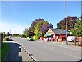
Shardlow Post Office & Store
On London Road.
Image: © Mike Faherty
Taken: 7 Oct 2012
0.12 miles