
IMAGES TAKEN NEAR TO
William Newton Close, DERBY, DE65 6HN
Introduction
This page details the photographs taken nearby to William Newton Close, DE65 6HN by members of the Geograph project.
The Geograph project started in 2005 with the aim of publishing, organising and preserving representative images for every square kilometre of Great Britain, Ireland and the Isle of Man.

There are currently over 7.5m images from over14,400 individuals and you can help contribute to the project by visiting https://www.geograph.org.uk
Image Map
Images are licensed for reuse under creativecommons.org/licenses/by-sa/2.0
Notes
- Clicking on the map will re-center to the selected point.
- The higher the marker number, the further away the image location is from the centre of the postcode.
Image Listing (19 Images Found)
Images are licensed for reuse under creativecommons.org/licenses/by-sa/2.0
Image
Details
Distance
1

William Newton Close
On the very edge of Eggington sits William Newton Close. A short cul-de-sac of semi-detached houses.
Image: © Malcolm Neal
Taken: 17 Jul 2017
0.04 miles
2

Cottages at Egginton
Dated 1908, and very much following the vernacular style of Charles Voysey, the well-known architect from the Arts and Crafts movement. Distinctive are the rough-cast finish, the battered buttresses, the fenestration and the chimney pots.
Image: © Alan Murray-Rust
Taken: 20 Feb 2014
0.11 miles
3

Bench mark, Egginton Pinfold
See http://www.geograph.org.uk/photo/3860629 for location.
Image: © Alan Murray-Rust
Taken: 20 Feb 2014
0.11 miles
4

Egginton Pinfold
Stone-built pinfold or village pound, possibly dating from the 17th century. Listed Grade II.
There is a bench mark http://www.geograph.org.uk/photo/3860635 to the left of the opening.
Image: © Alan Murray-Rust
Taken: 20 Feb 2014
0.11 miles
5

Egginton postbox ref DE65 757
Standard EIIR lampbox. Close to the site of the village Post Office, long since closed.
Image: © Alan Murray-Rust
Taken: 20 Feb 2014
0.11 miles
6

Ports Farmhouse
Typical 19th century 3-bay farmhouse on Duck Street.
Image: © Alan Murray-Rust
Taken: 20 Feb 2014
0.13 miles
7
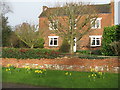
New Year's Day Daffodils
At Port Farm, Egginton.
Image: © M J Richardson
Taken: 1 Jan 2016
0.14 miles
8

Nissen hut barn at Peartree Farm
Second-hand Nissen huts were an inexpensive source of covered storage for farms after the second World War, but relatively few survive.
Image: © Alan Murray-Rust
Taken: 20 Feb 2014
0.15 miles
9

Paddock at Peartree Farm
Forming an open space in the centre of the village.
Image: © Alan Murray-Rust
Taken: 20 Feb 2014
0.15 miles
10

River level measurement station in Egginton
Walking along a footpath, I came across river level measurement station in Egginton. Note there is also a manual measuring gauge on the left.
Image: © Mangal
Taken: 21 Oct 2011
0.16 miles