
IMAGES TAKEN NEAR TO
Astley Gardens, DERBY, DE65 5NZ
Introduction
This page details the photographs taken nearby to Astley Gardens, DE65 5NZ by members of the Geograph project.
The Geograph project started in 2005 with the aim of publishing, organising and preserving representative images for every square kilometre of Great Britain, Ireland and the Isle of Man.

There are currently over 7.5m images from over14,400 individuals and you can help contribute to the project by visiting https://www.geograph.org.uk
Image Map
Images are licensed for reuse under creativecommons.org/licenses/by-sa/2.0
Notes
- Clicking on the map will re-center to the selected point.
- The higher the marker number, the further away the image location is from the centre of the postcode.
Image Listing (21 Images Found)
Images are licensed for reuse under creativecommons.org/licenses/by-sa/2.0
Image
Details
Distance
1

Chinese Restaurant near Hilton
The Mandarin situated near Hilton close to Egginton Junction.
Image: © Jonathan Clitheroe
Taken: 25 Apr 2015
0.02 miles
2
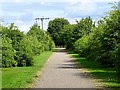
National Cycle Route 549 leaving Hilton
This short length of cycle path connects Hilton to the former Great Northern Railway cycle path, as part of National Route 549.
Image: © Ian Calderwood
Taken: 9 Jul 2017
0.04 miles
3

Bus Stop at Egginton Junction
Situated on the A5132 near Birch-trees Farm. The chimney (which is over the line in SK2629) stands next to the former Friargate railway line and marks the site of a former dairy.
Image: © Jonathan Clitheroe
Taken: 25 Apr 2015
0.14 miles
4

Egginton Junction Bridge
The sign seen in http://www.geograph.org.uk/photo/1659996 has been moved from inside the arch to the face of the parapet. The main arch has been partially filled in to create the ramp for the cycleway which now uses the old railway towards Derby.
Image: © Alan Murray-Rust
Taken: 20 Feb 2014
0.18 miles
5
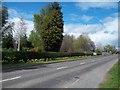
Entering Hilton along Egginton Road
Heading into the village from the south east via the A5132 Road.
Image: © Jonathan Clitheroe
Taken: 25 Apr 2015
0.18 miles
6

Cycle path on former railway
Towards Derby.
Image: © JThomas
Taken: 19 Apr 2013
0.18 miles
7

Egginton Junction Bridge, Derbyshire
The signpost for Egginton Junction Bridge, Derbyshire.
Image: © Eamon Curry
Taken: 4 Aug 2007
0.19 miles
8

Chimney at Egginton Junction
This is the site of a former dairy.
Image: © Jonathan Clitheroe
Taken: 25 Apr 2015
0.20 miles
9

Egginton Junction Bridge, Derbyshire
The end of the cycle/foot path and the Egginton Junction Bridge, Derbyshire.
Image: © Eamon Curry
Taken: 4 Aug 2007
0.20 miles
10
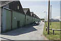
Old warehouses
These old warehouses on the edge of Hilton Business Park obviously predate what is now a fairly modern development. There is a sign saying these warehouses all have a fragile roof - it looked like asbestos.
Image: © Malcolm Neal
Taken: 17 Jul 2017
0.20 miles