
IMAGES TAKEN NEAR TO
Foss Road, DERBY, DE65 5BH
Introduction
This page details the photographs taken nearby to Foss Road, DE65 5BH by members of the Geograph project.
The Geograph project started in 2005 with the aim of publishing, organising and preserving representative images for every square kilometre of Great Britain, Ireland and the Isle of Man.

There are currently over 7.5m images from over14,400 individuals and you can help contribute to the project by visiting https://www.geograph.org.uk
Image Map
Images are licensed for reuse under creativecommons.org/licenses/by-sa/2.0
Notes
- Clicking on the map will re-center to the selected point.
- The higher the marker number, the further away the image location is from the centre of the postcode.
Image Listing (13 Images Found)
Images are licensed for reuse under creativecommons.org/licenses/by-sa/2.0
Image
Details
Distance
1
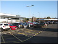
Lidl car park and Hilton Garage
On Egginton Road at Hilton. The Lidl store is relatively new, with no sign of any work on the site in June 2013 on Google Earth imagery.
Image: © M J Richardson
Taken: 29 Dec 2015
0.13 miles


4

Rother Close, Hilton
These relatively new houses are on the very edge of Hilton. This used to be a very small village outside Derby but has expanded hugely over the last 20 years and even has its own business park as well as 100's of new houses.
Image: © Malcolm Neal
Taken: 17 Jul 2017
0.15 miles
5
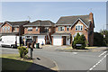
Washford Road, Hilton
Another part of the large housing development that has expanded the small village of Hilton to two or three times its original size.
Image: © Malcolm Neal
Taken: 17 Jul 2017
0.17 miles
7
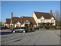
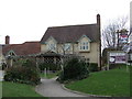
The Hilton Brook
A Marston's pub by the A5132 in Hilton.
Image: © M J Richardson
Taken: 29 Dec 2015
0.18 miles
8

Cycle path through Hilton
This cycle path connects Back Lane at its junction with Peacroft Lane with National Route 549 at The Mease. Part of the route approximately recreates a lost lane called Ivycroft Lane.
Image: © Ian Calderwood
Taken: 9 Jul 2017
0.20 miles
9

Path off Washford Road, Hilton
Heading in the general direction of Egginton Junction, it straightness and flatness giving the appearance of an ex railway line.
Image: © Richard Vince
Taken: 29 Aug 2020
0.20 miles
10
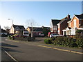
Welland Road, Hilton
Part of a large modern housing estate.
Image: © M J Richardson
Taken: 29 Dec 2015
0.22 miles