
IMAGES TAKEN NEAR TO
Ashbourne Road, ASHBOURNE, DE6 4NS
Introduction
This page details the photographs taken nearby to Ashbourne Road, DE6 4NS by members of the Geograph project.
The Geograph project started in 2005 with the aim of publishing, organising and preserving representative images for every square kilometre of Great Britain, Ireland and the Isle of Man.

There are currently over 7.5m images from over14,400 individuals and you can help contribute to the project by visiting https://www.geograph.org.uk
Image Map
Images are licensed for reuse under creativecommons.org/licenses/by-sa/2.0
Notes
- Clicking on the map will re-center to the selected point.
- The higher the marker number, the further away the image location is from the centre of the postcode.
Image Listing (24 Images Found)
Images are licensed for reuse under creativecommons.org/licenses/by-sa/2.0
Image
Details
Distance
1

A52 looking towards Derby
This is the main road from Derby to Ashbourne and is just outside the village of Kirk Langley.
Image: © Malcolm Neal
Taken: 11 May 2017
0.04 miles
2

Bus stop by A52 east of Kirk Langley
This provides a transport link for houses on the opposite side of the road
Image: © David Smith
Taken: 25 Apr 2022
0.05 miles
3

Bus stop on Ashbourne Road (A52), Kirk Langley
Image: © JThomas
Taken: 20 Jun 2015
0.06 miles
4

Old Milepost by the A52, Ashbourne Road, east of Kirk Langley
Cast iron post by the A52, in parish of KIRK LANGLEY (AMBER VALLEY District), Ashbourne Road, opposite Royal Oak Cottage, at eastern end of village, on wide verge with brambles, near bus stop, on South side of road. Harrison iron casting, erected by the Derby to Hurdloe House, Southern Div. turnpike trust in the 19th century. (Top broken off)
Inscription reads:-
: ASHBOURNE / 9 MILES : : (LONDON / 130 MILES) / BUXTON / 29 MILES / LANGLEY / PARISH : : DERBY / 4 MILES : : J. Harrison / DERBY :
Grade II Listed. List Entry Number:1158518
https://historicengland.org.uk/listing/the-list/list-entry/1158518
Milestone Society National ID: DE_LMA130.
Image: © A Rosevear
Taken: 1 Jan 2005
0.06 miles

7

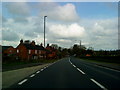
Crop field and hedgerow
Looking north from Ashbourne Road (A52).
Image: © JThomas
Taken: 20 Jun 2015
0.14 miles

9
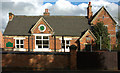
Kirk Langley Primary School
Located on Moor Lane, the school building dates from 1879. The right-hand end of the building is a private house. My grandparents lived there for many years, having moved there in the 1930s.
Image: © Phil Myott
Taken: 19 Oct 2006
0.16 miles
