IMAGES TAKEN NEAR TO
/Nether Lane/Well Banks, ASHBOURNE, DE6 3JW
Introduction
This page details the photographs taken nearby to /Nether Lane/Well Banks, DE6 3JW by members of the Geograph project.
The Geograph project started in 2005 with the aim of publishing, organising and preserving representative images for every square kilometre of Great Britain, Ireland and the Isle of Man.

There are currently over 7.5m images from over14,400 individuals and you can help contribute to the project by visiting https://www.geograph.org.uk
Image Map
Images are licensed for reuse under creativecommons.org/licenses/by-sa/2.0
Notes
- Clicking on the map will re-center to the selected point.
- The higher the marker number, the further away the image location is from the centre of the postcode.
Image Listing (31 Images Found)
Images are licensed for reuse under creativecommons.org/licenses/by-sa/2.0
Image
Details
Distance

2
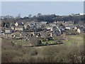
View of Kirk Ireton from the southeast
A good view of the village from the path between Winneyhill and Bullhill.
Image: © Andrew Hill
Taken: 6 Apr 2013
0.05 miles
3
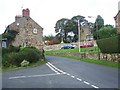
Lavender Cottage and Holy Trinity Church, Kirk Ireton
Image: © Geoff Pick
Taken: 30 Sep 2006
0.05 miles
4

Village Hall, Kirk Ireton
Kirk Ireton is 700ft above sea level, 4 miles south of Wirksworth.The village name is believed to mean 'Church of Irish Enclosure' and the village is possibly where Celtic missionaries originally settled.
Kirk Ireton was an agricultural village till the late 20th century, when the number of working farms dropped from 9 to 1 in the space of 25 years. Many of the farm buildings have been converted into homes. Much of the older part of the village dates back to the 17th century and is mostly built from gritstone, quarried locally.
One of the oldest buildings in the village is the Barley Mow pub, which was one of the last premises in the country to accept decimalisation, as the 87 year old landlady, a Mrs Ford, did not hold with the new money.
Kirk Ireton's Holy Trinity Church dates back to Norman times with the earliest parts being the 3 bayed south and north arcades. It has an interesting custom known as 'roping for weddings', when the village children put a rope across the road and the bride and groom are not allowed to leave the church until a toll has been paid in silver by the groom.
Kirk Ireton village still celebrates a Wakes week, which starts on Trinity Sunday, the church's patronal festival. A procession of villagers is led by a local brass band, from the Barley Mow pub to the church for thanksgiving.
Image: © Peter Barr
Taken: 6 Apr 2010
0.05 miles

6

Elizabeth II postbox on Main Street, Kirk Ireton
Postbox No. DE6 264.
Image: © JThomas
Taken: 21 Aug 2025
0.07 miles
7
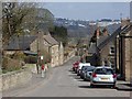
Main Street, Kirk Ireton
Looking down the main street of the village, which has a real air of a historic rural community.
Image: © Andrew Hill
Taken: 6 Apr 2013
0.08 miles
8
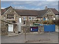
Kirk Ireton primary school
The school building is in keeping with the traditional village street.
Image: © Andrew Hill
Taken: 6 Apr 2013
0.08 miles
9
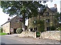
The Barley Mow and Post Office, Kirk Ireton
The Barlow Mow is one of Britain's few unspoilt pubs. Dating back to 1683, the pub has three small rooms where beer is served from the jug. It was one of the last pubs in Britain to accept Decimalisation as the then landlady, Mrs Ford, would not accept modern coinage between 1971 and her death in 1977.
Image: © Geoff Pick
Taken: 30 Sep 2006
0.09 miles