
IMAGES TAKEN NEAR TO
George Rodgers Close, ASHBOURNE, DE6 3GY
Introduction
This page details the photographs taken nearby to George Rodgers Close, DE6 3GY by members of the Geograph project.
The Geograph project started in 2005 with the aim of publishing, organising and preserving representative images for every square kilometre of Great Britain, Ireland and the Isle of Man.

There are currently over 7.5m images from over14,400 individuals and you can help contribute to the project by visiting https://www.geograph.org.uk
Image Map
Images are licensed for reuse under creativecommons.org/licenses/by-sa/2.0
Notes
- Clicking on the map will re-center to the selected point.
- The higher the marker number, the further away the image location is from the centre of the postcode.
Image Listing (13 Images Found)
Images are licensed for reuse under creativecommons.org/licenses/by-sa/2.0
Image
Details
Distance


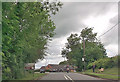
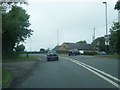
5
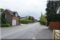
Hulland Ward Village
Hulland Ward is a village with a very mixed range of housing both in terms of age and size.
Image: © Malcolm Neal
Taken: 2 May 2019
0.09 miles


9
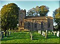
Christ Church, Hulland
Standing on high ground, Christ Church is an early Victorian parish church built in 1837 from local sandstone. It is Grade II listed.
Image: © Neil Theasby
Taken: 15 Oct 2021
0.16 miles
10
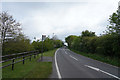
Between Hulland and Hulland Ward
The two villages share a name but are quite separate from each other.
Image: © Malcolm Neal
Taken: 2 May 2019
0.17 miles