IMAGES TAKEN NEAR TO
Longford, ASHBOURNE, DE6 3DF
Introduction
This page details the photographs taken nearby to DE6 3DF by members of the Geograph project.
The Geograph project started in 2005 with the aim of publishing, organising and preserving representative images for every square kilometre of Great Britain, Ireland and the Isle of Man.

There are currently over 7.5m images from over14,400 individuals and you can help contribute to the project by visiting https://www.geograph.org.uk
Image Map
Images are licensed for reuse under creativecommons.org/licenses/by-sa/2.0
Notes
- Clicking on the map will re-center to the selected point.
- The higher the marker number, the further away the image location is from the centre of the postcode.
Image Listing (7 Images Found)
Images are licensed for reuse under creativecommons.org/licenses/by-sa/2.0
Image
Details
Distance
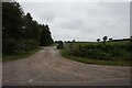
1
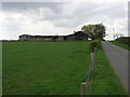
Silver Farm
Silverhill Farm appears to live up to its name in the fact the timber buildings have taken on a silver tone.
Image: © Michael Patterson
Taken: 27 Apr 2006
0.02 miles
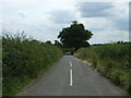
2
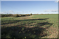
Silverhill Farm fields
New growth in this field at Silverhills Farm.
Image: © Malcolm Neal
Taken: 27 Oct 2017
0.12 miles
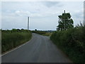
3
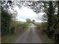
Bridge at Alder Carr
Silverhill Farm can also be seen here further up the lane.
Image: © Jonathan Clitheroe
Taken: 25 Oct 2014
0.17 miles