
IMAGES TAKEN NEAR TO
Ashbourne Road, ASHBOURNE, DE6 2LG
Introduction
This page details the photographs taken nearby to Ashbourne Road, DE6 2LG by members of the Geograph project.
The Geograph project started in 2005 with the aim of publishing, organising and preserving representative images for every square kilometre of Great Britain, Ireland and the Isle of Man.

There are currently over 7.5m images from over14,400 individuals and you can help contribute to the project by visiting https://www.geograph.org.uk
Image Map
Images are licensed for reuse under creativecommons.org/licenses/by-sa/2.0
Notes
- Clicking on the map will re-center to the selected point.
- The higher the marker number, the further away the image location is from the centre of the postcode.
Image Listing (13 Images Found)
Images are licensed for reuse under creativecommons.org/licenses/by-sa/2.0
Image
Details
Distance
2
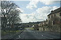
Mayfield going towards Ellastone
The road through Mayfield goes to Ellastone and eventually Uttoxeter.
Image: © Malcolm Neal
Taken: 4 Feb 2018
0.11 miles
3

Conygree Lane, Mayfield
Looking north.
Image: © David Weston
Taken: 10 May 2017
0.14 miles
4
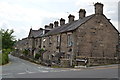
Mill housing
Built by Quaker yarn mill owners, Joseph and George Simpson, for their workforce. This is one of five terraced blocks in the village. These blocks are Doveside (1871) and Holme Bank (1872).
Image: © John M
Taken: 25 Jun 2013
0.14 miles
5
Tom Moors Cottage Farm
Taken from Wallash looking towards Upper Mayfield.
Image: © Pat Poyser
Taken: 3 Mar 2007
0.15 miles
6
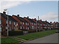
East View Mayfield
Typical 1950s Council Houses.
Image: © Pat Poyser
Taken: 3 Mar 2007
0.15 miles
7
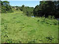
Footpath towards Hanging Bridge, Mayfield
Image: © Chris Wimbush
Taken: 16 Jun 2010
0.17 miles
8
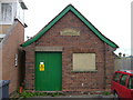
Municipal electricity
Sub-station next to Mayfield Post Office, Staffordshire. Inscription reads "A U D C Electricity". AUDC is Ashbourne Urban District Council which was one of many local authorities who ran an electricity supply undertaking before nationalisation in 1947 http://en.wikipedia.org/wiki/List_of_pre-nationalisation_UK_electric_power_companies . In this case they were supplying electricity across the River Dove, out of their District and indeed out of their county, Derbyshire.
Image: © Roger W Haworth
Taken: 17 Aug 2006
0.17 miles
9
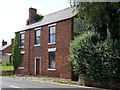
The former New Inn
With the fading remains of the Bass banner still on the gable end.
Image: © Ian Calderwood
Taken: 23 Aug 2016
0.20 miles
10
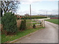
Playing Fields
Football pitch, bowling green and hard play area.
Conyree Lane, Mayfield.
Image: © Pat Poyser
Taken: 12 Mar 2007
0.21 miles