
IMAGES TAKEN NEAR TO
Weirside, ASHBOURNE, DE6 2JG
Introduction
This page details the photographs taken nearby to Weirside, DE6 2JG by members of the Geograph project.
The Geograph project started in 2005 with the aim of publishing, organising and preserving representative images for every square kilometre of Great Britain, Ireland and the Isle of Man.

There are currently over 7.5m images from over14,400 individuals and you can help contribute to the project by visiting https://www.geograph.org.uk
Image Map
Images are licensed for reuse under creativecommons.org/licenses/by-sa/2.0
Notes
- Clicking on the map will re-center to the selected point.
- The higher the marker number, the further away the image location is from the centre of the postcode.
Image Listing (20 Images Found)
Images are licensed for reuse under creativecommons.org/licenses/by-sa/2.0
Image
Details
Distance
1
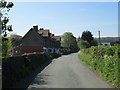
Conygree Lane, Mayfield
Looking south, along the lane to the church.
Image: © David Weston
Taken: 10 May 2017
0.04 miles
2
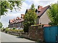
Mill workers housing
Built by Quaker yarn mill owners, Joseph and George Simpson, for their workforce there are five terraced blocks in the village. These are the later Weirside (1914) and Meadowside (1913).
Image: © John M
Taken: 25 Jun 2013
0.05 miles
3
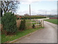
Playing Fields
Football pitch, bowling green and hard play area.
Conyree Lane, Mayfield.
Image: © Pat Poyser
Taken: 12 Mar 2007
0.10 miles
4
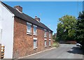
Church Row in Church Mayfield
These are some of the oldest dwellings in the village and according to the information board nearby, originally consisted of one long unbroken terrace. The parapeted Mayfield House is also partially visible behind the foliage at the end of Church Lane. To the left of the house and out of sight is a former Quaker Meeting House.
Image: © Jonathan Clitheroe
Taken: 6 Jul 2013
0.11 miles
5
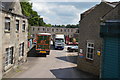
Mayfield Yarns - Yarn Mill Yard
The major employer in Mayfield.
Image: © John M
Taken: 25 Jun 2013
0.14 miles
6

Mayfield Mill, Church Mayfield
Mayfield Mill has a long history of textile production dating from 1795 when a cotton mill was built on a former site of industry. The mill was rebuilt in 1806 following a fire. Following changes of ownership the mill moved to silk production in 1934. Mayfield Yarns have owned the mill since 1980 and are engaged in synthetic yarn manufacture. The old part of the mill as seen here is disused and threatened with demolition.
Image: © Chris Allen
Taken: 11 May 2025
0.16 miles
7
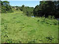
Footpath towards Hanging Bridge, Mayfield
Image: © Chris Wimbush
Taken: 16 Jun 2010
0.16 miles
8
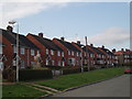
East View Mayfield
Typical 1950s Council Houses.
Image: © Pat Poyser
Taken: 3 Mar 2007
0.16 miles
9

Mayfield Mill, Church Mayfield
Mayfield Mill has a long history of textile production dating from 1795 when a cotton mill was built on a former site of industry. The mill was rebuilt in 1806 following a fire. Following changes of ownership the mill moved to silk production in 1934. Mayfield Yarns have owned the mill since 1980 and are engaged in synthetic yarn manufacture. The old part of the mill as seen here is disused and threatened with demolition. The terraced houses were for the mill workers.
There is an appreciable flow of water under the nearest building and it is possible the site has a water turbine supplied from above the weir on the River Dove. This water would be the tail race.
Image: © Chris Allen
Taken: 11 May 2025
0.17 miles
10
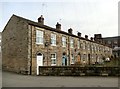
The Terrace, Church Mayfield
One of five similar rows built in 1849 by Joseph and George Simpson for the workers at their adjacent cotton mill. The mill is still producing yarn today http://www.mayfieldyarns.co.uk/about
Image: © Graham Hogg
Taken: 13 Mar 2017
0.17 miles