
IMAGES TAKEN NEAR TO
Sides Lane, ASHBOURNE, DE6 2GQ
Introduction
This page details the photographs taken nearby to Sides Lane, DE6 2GQ by members of the Geograph project.
The Geograph project started in 2005 with the aim of publishing, organising and preserving representative images for every square kilometre of Great Britain, Ireland and the Isle of Man.

There are currently over 7.5m images from over14,400 individuals and you can help contribute to the project by visiting https://www.geograph.org.uk
Image Map
Images are licensed for reuse under creativecommons.org/licenses/by-sa/2.0
Notes
- Clicking on the map will re-center to the selected point.
- The higher the marker number, the further away the image location is from the centre of the postcode.
Image Listing (9 Images Found)
Images are licensed for reuse under creativecommons.org/licenses/by-sa/2.0
Image
Details
Distance
1

Farm buildings at Sides Mill Farm
The village of Mayfield can be seen on the other side of the Dove.
Image: © Bill Boaden
Taken: 15 Mar 2014
0.02 miles
2

The track to a farm
Branching from Sides Lane is this track to a farm that does not appear to be named on the OS map of the area.
Image: © Malcolm Neal
Taken: 11 Jul 2019
0.05 miles
3
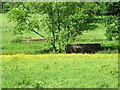
Former railway bridge over a former mill race
This bridge used to carry the North Staffordshire Railway Ashbourne Branch over the mill race at Sides Mill. Sides Mill was a corn mill which went out of use in the late 19th century and is now Sidesmill Farm. The Ashbourne Branch of the N.S.R. opened in 1852 and closed in 1963 with the track being lifted in 1964.
Image: © Ian Calderwood
Taken: 3 Jun 2017
0.08 miles
4

Footpath on the old railway
The footpath from Snelston to Clifton runs along the trackbed of the former North Staffordshire Railway Ashbourne Branch for a short distance near Sidesmill Farm. The Ashbourne Branch opened in 1852 and closed in 1963 with the track being lifted in 1964.
Image: © Ian Calderwood
Taken: 3 Jun 2017
0.10 miles
5

The River Dove near Mayfield
The river is the boundary between Staffordshire (on this side) and Derbyshire (the other side).
Image: © David Weston
Taken: 10 May 2017
0.17 miles

7

The valley of the Dove below Mayfield
In the foreground is a drainage channel and the route of an old railway. The River Dove is a little bit beyond. This is viewed on a hazy day when the light is just beginning to fade.
Image: © Bill Boaden
Taken: 15 Mar 2014
0.23 miles

9

A field near Clifton
A field of what looks like rough grazing near Clifton Village.
Image: © Malcolm Neal
Taken: 11 Jul 2019
0.24 miles