IMAGES TAKEN NEAR TO
Darley Moor, ASHBOURNE, DE6 2ET
Introduction
This page details the photographs taken nearby to DE6 2ET by members of the Geograph project.
The Geograph project started in 2005 with the aim of publishing, organising and preserving representative images for every square kilometre of Great Britain, Ireland and the Isle of Man.

There are currently over 7.5m images from over14,400 individuals and you can help contribute to the project by visiting https://www.geograph.org.uk
Image Map
Images are licensed for reuse under creativecommons.org/licenses/by-sa/2.0
Notes
- Clicking on the map will re-center to the selected point.
- The higher the marker number, the further away the image location is from the centre of the postcode.
Image Listing (15 Images Found)
Images are licensed for reuse under creativecommons.org/licenses/by-sa/2.0
Image
Details
Distance
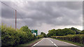
1
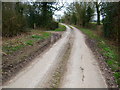
Stydd Lane
Looking back to the A515, up the no through road.
Image: © John Poyser
Taken: 15 Mar 2007
0.05 miles
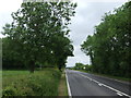
5
Approaching Cockshead Lane junction at Darley Moor
Image: © John Firth
Taken: 15 Jun 2013
0.14 miles
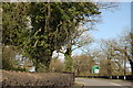
6
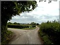
Track Junction near Top Stydd
The left fork goes to Top Stydd while the track and footpath ahead drops down to Stydd Hall.
Image: © Jonathan Clitheroe
Taken: 30 Aug 2014
0.23 miles
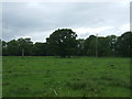
7
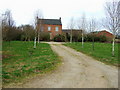
Manor House
The Manor House near Cubley
Image: © John Poyser
Taken: 14 Mar 2007
0.24 miles
8
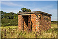
WWII Derbyshire: RAF Darley Moor - Bulk Aviation Fuel Store (3)
Pump house.
Image
Image: © Mike Searle
Taken: 14 Sep 2020
0.24 miles
9
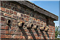
WWII Derbyshire: RAF Darley Moor - Bulk Aviation Fuel Store (4)
Outlet pipes from the pump.
Image
Image: © Mike Searle
Taken: 14 Sep 2020
0.24 miles
10
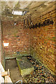
WWII Derbyshire: RAF Darley Moor - Bulk Aviation Fuel Store (5)
The inlet pipe providing fuel from an underground tank to the fuel pump on the plinth can be seen on the left. Multiple outlet pipes on the right would have supplied fuel bowsers outside.
Image
Image: © Mike Searle
Taken: 14 Sep 2020
0.24 miles