
IMAGES TAKEN NEAR TO
Derby Road, RIPLEY, DE5 8LG
Introduction
This page details the photographs taken nearby to Derby Road, DE5 8LG by members of the Geograph project.
The Geograph project started in 2005 with the aim of publishing, organising and preserving representative images for every square kilometre of Great Britain, Ireland and the Isle of Man.

There are currently over 7.5m images from over14,400 individuals and you can help contribute to the project by visiting https://www.geograph.org.uk
Image Map
Images are licensed for reuse under creativecommons.org/licenses/by-sa/2.0
Notes
- Clicking on the map will re-center to the selected point.
- The higher the marker number, the further away the image location is from the centre of the postcode.
Image Listing (17 Images Found)
Images are licensed for reuse under creativecommons.org/licenses/by-sa/2.0
Image
Details
Distance
1

Industrial Estate
A small industrial estate at Rawson Green
Image: © Jay Pea
Taken: 2 Aug 2025
0.03 miles
2
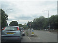
Cross roads near Kilburn
Junction of B6179 and A609
Image: © John Firth
Taken: 13 Jul 2011
0.05 miles
4

Bottle Brook under the A609
At Denby Bottles, at the junction with the Derby Road, a brook flows through a culvert.
Image: © Peter Barr
Taken: 28 Oct 2010
0.07 miles
6
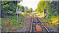
Site of Kilburn station, 1998
View NE, towards Ripley and Butterley: ex-Midland (Derby) - Little Eaton Junction - Ripley - Butterley branch. The line remained open until 2011 as far as Denby, to serve a coal-washery, having lost its passenger service 1/6/30 and normal goods traffic from 1/4/63.
Image: © Ben Brooksbank
Taken: 20 Jun 1998
0.09 miles
7
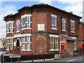
Kilburn - Station Hotel
Kilburn Station was a short distance away from the Station Hotel, but it was closed to passengers in 1930. The Station Hotel is now a nursery called Play Station. For an alternative view of the hotel, please see Image
Image: © Dave Bevis
Taken: 30 Jul 2011
0.10 miles
8

Site of Kilburn Station
This was the site of Kilburn Station on the branch to Ripley. The station was closed to passenger traffic in 1930, but the line continued for freight traffic as far as Denby until recently. This fence has now replaced the level crossing gates here on the A609 Ilkeston - Belper road.
Image: © Stephen McKay
Taken: 18 Jun 2006
0.10 miles
9
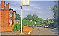
Kilburn: approaching level-crossing at former station, 1998
View eastward by the Station Hotel. The blue car is just leaving Brickyard Lane and the crossing is just after it: Ripley and Butterley to the left, Little Eaton Junction to the right. The station had been on the right, closed 1/6/30. (See also Image]).
Image: © Ben Brooksbank
Taken: 20 Jun 1998
0.10 miles
10
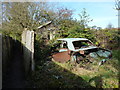
Abandoned car in Denby Bottles
Vauxhall HB Viva car, identified by a gentleman who can remember when it still had windows, and other working parts. The car was abandoned to gently rot away, in a part of a garden in which the owner's wife used to keep donkeys.
Image: © Peter Barr
Taken: 28 Oct 2010
0.11 miles