1
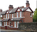
Royal Mail Sorting and Delivery Office at Belper
The original Victorian Post and Sorting Office in the town closed down and was replaced with this modern building on the outskirts of the town.
Image: © Martin Froggatt
Taken: 17 May 2020
0.01 miles
2
Derby Road at the junction of Goods Road
This leads to a small industrial estate by the River Derwent
Image: © David Howard
Taken: 5 Jun 2022
0.03 miles
3
Lane off Derby Road, Belper
Image: © Richard Vince
Taken: 19 Apr 2019
0.04 miles
4
Belper - The Tavern
On Derby Road.
Image: © Dave Bevis
Taken: 19 Oct 2012
0.04 miles
5
Babington Hospital; pedestrian entrance
Like many present day hospitals, this was once a workhouse. Soon after it opened in 1840, the weekly provisions bill was around £17 for the 158 inmates. Boy inmates were taught shoemaking and tailoring. http://www.workhouses.org.uk/index.html?Belper/Belper.shtml
After 1930, control of the site passed to Derbyshire County Council and became Babington House Public Assistance Institution. Between 1930 and 1941, the council undertook an extensive modernisation scheme. Following the inauguration of the National Health Service in 1948, the institution was renamed Babington Hospital providing care for 155 geriatric and 16 maternity patients.
The Hospital now concentrates on providing "a multi-disciplinary rehabilitation service mainly for older people". Other services based on the site include the Day Unit, the base for Community Rehabilitation / Intermediate Care Team, Physiotherapy and Occupational Therapy Outpatient Services, Trust Headquarters and Public Health.
Image: © Peter Barr
Taken: 25 Sep 2010
0.06 miles
6
River Derwent View showing Overflow Pipe from Sewage Works
Image: © Alan Heardman
Taken: 24 Mar 2008
0.07 miles
7
South entrance, Babington Hospital, Belper
Off Derby Road.
Image: © Richard Vince
Taken: 19 Apr 2019
0.07 miles
8
River Derwent
The River Derwent in Derbyshire between Belper and Milford. This is an upstream view looking towards Belper. This section is compounded by weirs at Belper and Milford which were built in the late 18th century to divert water for use in powering cotton mills.
Image: © Martin Froggatt
Taken: 17 May 2020
0.07 miles
9
Derby Road, Belper
Approaching the town centre from the south.
Image: © Richard Vince
Taken: 19 Apr 2019
0.08 miles
10
Belper - Derby Road No 45
The maroon-painted woodwork on this house tempts me to suggest that it was built by the Midland Railway. This is further supported by its closeness to the A6 road bridge over the railway line. However, the house is not on Amber Valley Borough Council's register of listed buildings (see http://opengov.ambervalley.gov.uk/docarc/docviewer.aspx?docGuid=175e860e20224090a2bc1131fe03c71d ).
Image: © Dave Bevis
Taken: 19 Oct 2012
0.08 miles


