1
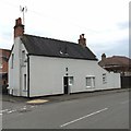
Houses off Broadway, Duffield
Image: © JThomas
Taken: 26 Apr 2014
0.10 miles
2
Cumberhills Road
This is the very end (or start) of Cumberhills Road in the village of Duffield. The houses on Cumberhills Road are rather older than the surrounding houses visible in the picture.
Image: © Malcolm Neal
Taken: 5 Oct 2017
0.10 miles
3
Footpath to Wirksworth Road, Duffield
From Curzon Lane.
Image: © Richard Vince
Taken: 21 Dec 2019
0.13 miles
4
West end of Curzon Lane, Duffield
Image: © Richard Vince
Taken: 21 Dec 2019
0.14 miles
5
Tollhouse by Wirksworth Road, Duffield parish
In the parish of Duffield (Amber Valley District), No. 67, Wirksworth Road, (at the junction with New Zealand Road), DE56 4GY.
To be surveyed
Milestone Society National ID: DE.DUF02
Image: © Alan Rosevear
Taken: 21 Mar 2016
0.14 miles
6
Curzon Lane, Duffield
Off Devonshire Drive.
Image: © Richard Vince
Taken: 21 Dec 2019
0.14 miles
7
Bridge and weir on the River Ecclesbourne
By the site of an old corn mill, this now seems to be the main river channel but on old maps it is marked as the mill lade with the river looping round to the south.
Image: © Ian Calderwood
Taken: 25 Nov 2016
0.16 miles
8
Wirksworth Road Duffield
Moving towards the centre of the village of Duffield and soon to be passing the Ecclebourne Secondary School.
Image: © Malcolm Neal
Taken: 5 Oct 2017
0.17 miles
9
Old Milepost by the B5023, Broadway, Duffield
Cast iron post by the B5023, in parish of DUFFIELD (AMBER VALLEY District), Wirksworth Road; South East of Broome Park, outside "The Kirkstyles", on well kept grass verge between road and hedge, on West side of road. Harrison iron casting, erected by the Ideridgehay & Duffield turnpike trust in the 19th century.
Inscription reads:-
: WIRKSW.H / 8 / MILES : : Duffield / - / LONDON / 131 / MILES : : DERBY / 5 / MILES : : J. Harrison / DERBY :
Grade II Listed. List Entry Number:1109123
https://historicengland.org.uk/listing/the-list/list-entry/1109123
Milestone Society National ID: DE_DEWW05.
Image: © A Rosevear & J Higgins
Taken: 1 Feb 2002
0.17 miles
10
Old Milepost by the B5023, Broadway, Duffield
Cast iron post by the B5023, in parish of DUFFIELD (AMBER VALLEY District), Wirksworth Road; South East of Broome Park, outside "The Kirkstyles", on well kept grass verge between road and hedge, on West side of road. Harrison iron casting, erected by the Ideridgehay & Duffield turnpike trust in the 19th century. An earlier photograph can be found here https://www.geograph.org.uk/photo/5623809.
Inscription reads:-
: WIRKSW.H / 8 / MILES : : Duffield / - / LONDON / 131 / MILES : : DERBY / 5 / MILES : : J. Harrison / DERBY :
Grade II Listed. List Entry Number:1109123 https://historicengland.org.uk/listing/the-list/list-entry/1109123
Milestone Society National ID: DE_DEWW05.
Image: © Martin Shattock
Taken: 4 Aug 2023
0.17 miles


