
IMAGES TAKEN NEAR TO
Ashbourne Road, BELPER, DE56 2LG
Introduction
This page details the photographs taken nearby to Ashbourne Road, DE56 2LG by members of the Geograph project.
The Geograph project started in 2005 with the aim of publishing, organising and preserving representative images for every square kilometre of Great Britain, Ireland and the Isle of Man.

There are currently over 7.5m images from over14,400 individuals and you can help contribute to the project by visiting https://www.geograph.org.uk
Image Map
Images are licensed for reuse under creativecommons.org/licenses/by-sa/2.0
Notes
- Clicking on the map will re-center to the selected point.
- The higher the marker number, the further away the image location is from the centre of the postcode.
Image Listing (44 Images Found)
Images are licensed for reuse under creativecommons.org/licenses/by-sa/2.0
Image
Details
Distance

2

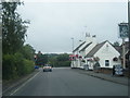
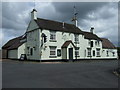
Cowers Lane - Crossroads and The Railway public house
Image: © Alan Heardman
Taken: 20 Jun 2011
0.05 miles
5

Cowers Lane Telephone Exchange
Taken in bright sunlight, this TE with a red K6 telephone box in the foreground, is one of several TEs in the United Kingdom dating from the GPO era, ie before 1969. It is situated on the B5023 Wirksworth Road and both buildings would appear to be in use, the front smaller building having a ventilation louvre above its brown door. Besides Cowers Lane, this TE also serves Idridgehay, Shottle, Turnditch and Windley nearby. The numbering range of this TE is (01773) 550xxx, the (01773) referring to the Ripley group of TEs, and its postcode is DE56 2LS. Update: the red K6 telephone box has since been removed from this location.
Image: © David Hillas
Taken: 4 Jul 2014
0.06 miles
6

Shottle station
Now a private residence. Last used by passengers when the Wirksworth branch passenger service was suspended in 1947.
Image: © John Lucas
Taken: 19 Jun 2018
0.07 miles
7
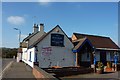
The Railway, a pub at Cowers Lane
At the crossroads of the A517 and the B5023, three miles west of Belper.The railway line is the Ecclesbourne Valley Railway, a community owned venture, running tourist rail trips between Duffield and Wirksworth, the Grand Opening day of which is to be Friday 8th April 2011, and the weekend.
Image: © Peter Barr
Taken: 7 Mar 2011
0.07 miles
8
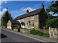
Forge Cottage
Forge Cottage is marked on old Ordnance Survey maps, up until the 1950s, as a smithy.
Image: © Ian Calderwood
Taken: 15 May 2016
0.07 miles
9

Shottle Station - Ecclesbourne Valley Railway
The platform is used by the heritage trains but the station is now a private residence.
Image: © Chris Allen
Taken: 13 Mar 2016
0.07 miles
10

Ecclesbourne Valley Railway - Shottle Station
The exit, as the original station is now a private residence. This is a preserved railway that provides a service to the local community with diesel multiple unit sets. On special days heritage diesel locomotives or steam locomotives are pressed into use. The road bridge carries the A517.
Image: © Chris Allen
Taken: 13 Mar 2016
0.07 miles