
IMAGES TAKEN NEAR TO
Riverside Court, BELPER, DE56 2GX
Introduction
This page details the photographs taken nearby to Riverside Court, DE56 2GX by members of the Geograph project.
The Geograph project started in 2005 with the aim of publishing, organising and preserving representative images for every square kilometre of Great Britain, Ireland and the Isle of Man.

There are currently over 7.5m images from over14,400 individuals and you can help contribute to the project by visiting https://www.geograph.org.uk
Image Map
Images are licensed for reuse under creativecommons.org/licenses/by-sa/2.0
Notes
- Clicking on the map will re-center to the selected point.
- The higher the marker number, the further away the image location is from the centre of the postcode.
Image Listing (86 Images Found)
Images are licensed for reuse under creativecommons.org/licenses/by-sa/2.0
Image
Details
Distance
1
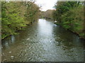
River Derwent
The river just south of Holly lane.
Image: © John Poyser
Taken: 29 Apr 2008
0.03 miles
2
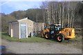
Railway maintenance equipment
At Ambergate junction.
Image: © Andrew Abbott
Taken: 23 Feb 2020
0.04 miles

4

Across the valley
From the end of Whitewells lane looking down into Ambergate with the railway, then up to Toadmoor.
Image: © John Poyser
Taken: 1 May 2008
0.05 miles
5

Ambergate - western railway viaduct over A6
This viaduct carries the Matlock branch line.
Image: © Dave Bevis
Taken: 22 Oct 2009
0.05 miles
6

Light at the end of the tunnel
Ambergate, Derbyshire.
Image: © Peter Barr
Taken: 2 Sep 2010
0.06 miles
7
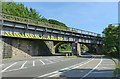
Railway bridges at Ambergate
View from the north west showing the later 1930-31 girder bridge, and beyond the arches of the original 1836-40 Derwent Viaduct http://www.geograph.org.uk/photo/5432898
Image: © Alan Murray-Rust
Taken: 17 Jun 2017
0.06 miles
8
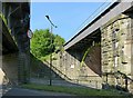
Railway bridges at Ambergate
On the right is one of the original arches of the Derwent Viaduct, built 1836-40 for the North Midland Railway under the auspices of George and Robert Stephenson, and now Listed Grade II*. http://www.geograph.org.uk/photo/5432898 The bridge was widened and the new bridge built to the left when the junction at Ambergate was remodelled and improved in 1930-31 by the London Midland and Scottish Railway.
Image: © Alan Murray-Rust
Taken: 17 Jun 2017
0.07 miles
9

St Anne's Church, Ambergate
Anglican church on Derby Road
Image: © Eirian Evans
Taken: 26 Jul 2012
0.07 miles
10
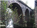
Ambergate - eastern railway viaduct over A6
This viaduct carries the Derby to Chesterfield main line. The photo is taken from under the viaduct carrying the Matlock branch line - see Image for photo of this.
Image: © Dave Bevis
Taken: 22 Oct 2009
0.07 miles