
IMAGES TAKEN NEAR TO
Brooke Close, BELPER, DE56 1SY
Introduction
This page details the photographs taken nearby to Brooke Close, DE56 1SY by members of the Geograph project.
The Geograph project started in 2005 with the aim of publishing, organising and preserving representative images for every square kilometre of Great Britain, Ireland and the Isle of Man.

There are currently over 7.5m images from over14,400 individuals and you can help contribute to the project by visiting https://www.geograph.org.uk
Image Map
Images are licensed for reuse under creativecommons.org/licenses/by-sa/2.0
Notes
- Clicking on the map will re-center to the selected point.
- The higher the marker number, the further away the image location is from the centre of the postcode.
Image Listing (182 Images Found)
Images are licensed for reuse under creativecommons.org/licenses/by-sa/2.0
Image
Details
Distance
1

Brook Cottage, Belper
The house dates back to at least 1790, although substantially remodelled in the 19th century. It was the house of the manager of the hosiery factories of Ward Brettles and Ward before becoming part of the Silkolene lubricants business. Currently unoccupied and signed as 'unsafe building'. Listed Grade II.
Image: © Alan Murray-Rust
Taken: 9 Jul 2017
0.03 miles
2

Belper - former Wards hosiery mill
Currently waiting for development, this building is part of the site of the former Silkolene works. In an earlier life, this was Ward's hosiery mill. See the Conservation Area Character Statement document, section J (see http://opengov.ambervalley.gov.uk/docarc/docviewer.aspx?docGuid=e9c1614270044e3fa901ff34818e07c9 ) for more details.
Image: © Dave Bevis
Taken: 19 Oct 2012
0.04 miles
3
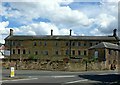
Former hosiery warehouse, Belper
Built between 1802 and 1834 as a warehouse for the products of domestic framework knitters, later part of the premises of Silkolene lubricants, currently unoccupied. Listed Grade II.
Image: © Alan Murray-Rust
Taken: 9 Jul 2017
0.05 miles
4

Block refurbishment on Derby Road, Belper
This looks like one of the many mills in the area and is now being converted into flats.
Image: © David Howard
Taken: 5 Jun 2022
0.05 miles
5

Derelict site in Belper
By the junction of the A6 and A609, a dilapidated building whose owners may be seeking to turn it into a hotel.
Image: © Peter Barr
Taken: 20 Dec 2011
0.05 miles
6

Flying Geese Sculpture
On the busy island of the A6.
Image: © JThomas
Taken: 13 Mar 2005
0.06 miles
7

Belper - New Road shops below Campbell Street junction
Image: © Dave Bevis
Taken: 7 May 2013
0.07 miles
8

Belper - Meadow View No 1
The first house in a row of terraces off the A6 Derby Road.
Image: © Dave Bevis
Taken: 30 Apr 2013
0.07 miles

