
IMAGES TAKEN NEAR TO
Short Street, BELPER, DE56 1JU
Introduction
This page details the photographs taken nearby to Short Street, DE56 1JU by members of the Geograph project.
The Geograph project started in 2005 with the aim of publishing, organising and preserving representative images for every square kilometre of Great Britain, Ireland and the Isle of Man.

There are currently over 7.5m images from over14,400 individuals and you can help contribute to the project by visiting https://www.geograph.org.uk
Image Map
Images are licensed for reuse under creativecommons.org/licenses/by-sa/2.0
Notes
- Clicking on the map will re-center to the selected point.
- The higher the marker number, the further away the image location is from the centre of the postcode.
Image Listing (26 Images Found)
Images are licensed for reuse under creativecommons.org/licenses/by-sa/2.0
Image
Details
Distance
1
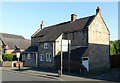
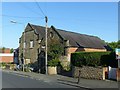
20, Kilbourne Road, Belper
Early 18th century stone house, Listed Grade II.
Image: © Alan Murray-Rust
Taken: 17 Jun 2017
0.05 miles
2
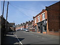
Western section of Kilbourne Road, Belper
Looking towards the point at which it becomes Spencer Road on its way to the town centre.
Image: © Richard Vince
Taken: 19 Apr 2019
0.05 miles
3
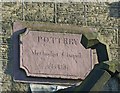
Pottery Methodist Chapel, Belper
Datestone of 1816. Noted the mason's error – the name was clearly originally incorrectly incised as POTTREY. See http://www.geograph.org.uk/photo/5435520 for location.
Image: © Alan Murray-Rust
Taken: 17 Jun 2017
0.06 miles
4
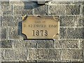
Pottery Methodist Chapel, Belper
Datestone on the Sunday School. This is not the foundation stone itself, being situated high in the gable of the building. See http://www.geograph.org.uk/photo/5435520 for location.
Image: © Alan Murray-Rust
Taken: 17 Jun 2017
0.06 miles
5
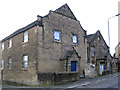
Pottery Methodist Chapel, Belper
The nearer range is the Sunday School of 1878, with the chapel of 1816 beyond. The design of the gable end is unusual. The buildings are Listed Grade II, but have clearly been out of use for some time and looking desolate.
There is a bench mark http://www.geograph.org.uk/photo/5435543 on the far corner of the frontage wall.
Image: © Alan Murray-Rust
Taken: 17 Jun 2017
0.06 miles
7
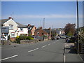
East end of Spencer Road, Belper
Looking towards Kilbourne Road.
Image: © Richard Vince
Taken: 19 Apr 2019
0.07 miles
8
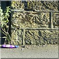
Bench mark, Pottery Methodist Chapel, Belper
See http://www.geograph.org.uk/photo/5435520 for location.
Image: © Alan Murray-Rust
Taken: 17 Jun 2017
0.07 miles
9
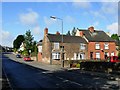
Spencer Road, Belper
Looking towards the town centre.
Image: © Stephen McKay
Taken: 3 Sep 2006
0.08 miles
10
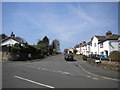
East end of Marsh Lane, Belper
Seen from Spencer Road.
Image: © Richard Vince
Taken: 19 Apr 2019
0.09 miles