IMAGES TAKEN NEAR TO
Chapel Street, BELPER, DE56 0PB
Introduction
This page details the photographs taken nearby to Chapel Street, DE56 0PB by members of the Geograph project.
The Geograph project started in 2005 with the aim of publishing, organising and preserving representative images for every square kilometre of Great Britain, Ireland and the Isle of Man.

There are currently over 7.5m images from over14,400 individuals and you can help contribute to the project by visiting https://www.geograph.org.uk
Image Map
Images are licensed for reuse under creativecommons.org/licenses/by-sa/2.0
Notes
- Clicking on the map will re-center to the selected point.
- The higher the marker number, the further away the image location is from the centre of the postcode.
Image Listing (22 Images Found)
Images are licensed for reuse under creativecommons.org/licenses/by-sa/2.0
Image
Details
Distance
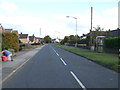
2
Bench mark and air valve, Chapel Street, Kilburn
See http://www.geograph.org.uk/photo/5436403 for location. BRDC on the valve location sign represents the long defunct Belper Rural District Council.
Image: © Alan Murray-Rust
Taken: 19 Jun 2017
0.04 miles
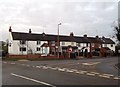
3
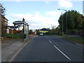
Bus stop and shelter on Chapel Street, Kilburn
Heading east.
Image: © JThomas
Taken: 20 Oct 2015
0.05 miles
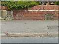
4
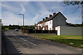
East end of Chapel Street, Kilburn
There is a bench mark http://www.geograph.org.uk/photo/5436407 at the right hand side of the driveway of the nearest house.
Image: © Alan Murray-Rust
Taken: 19 Jun 2017
0.05 miles
5
Bottle Brook Houses
Bottle Brook Houses, taken looking towards Kilburn, with Bottle Brook behind the wall whose shadow can be seen bottom left of the photograph.
Image: © Rob Bradford
Taken: 21 May 2005
0.10 miles
6
Bottle Brook Houses
Situated at a T-junction near the southern edge of the grid square.
Image: © Jonathan Clitheroe
Taken: 25 Jan 2014
0.13 miles
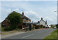
7
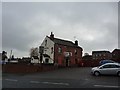
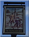
The Travellers' Rest
Kilburn pub, on Chapel Street.
Image: © Peter Barr
Taken: 26 Nov 2012
0.13 miles
8
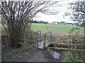
Path and Footbridge near Kilburn
This public footpath leads up to Ryknield Road and the eastern fringes of Kilburn.
Image: © Jonathan Clitheroe
Taken: 25 Jan 2014
0.14 miles
10
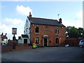
The Travellers Rest, Kilburn
On Chapel Street.
Image: © JThomas
Taken: 20 Oct 2015
0.16 miles