
IMAGES TAKEN NEAR TO
Horsley Road, BELPER, DE56 0NE
Introduction
This page details the photographs taken nearby to Horsley Road, DE56 0NE by members of the Geograph project.
The Geograph project started in 2005 with the aim of publishing, organising and preserving representative images for every square kilometre of Great Britain, Ireland and the Isle of Man.

There are currently over 7.5m images from over14,400 individuals and you can help contribute to the project by visiting https://www.geograph.org.uk
Image Map
Images are licensed for reuse under creativecommons.org/licenses/by-sa/2.0
Notes
- Clicking on the map will re-center to the selected point.
- The higher the marker number, the further away the image location is from the centre of the postcode.
Image Listing (9 Images Found)
Images are licensed for reuse under creativecommons.org/licenses/by-sa/2.0
Image
Details
Distance
1

Coming in to Kilburn
Kilburn is a rather larger village than Horsley but serves the same dormitory purpose.
Image: © Malcolm Neal
Taken: 26 Apr 2018
0.06 miles
2
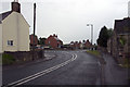
A609, Horsley, Road Junction, Kilburn
A609, Horsley-Lower Kilburn, Road Junction, Kilburn, Derbyshire, SK377455
Image: © Rob Bradford
Taken: 30 May 2005
0.07 miles
3
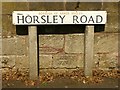
Bench mark, Horsley Road, Kilburn
See http://www.geograph.org.uk/photo/5467571 for location.
Image: © Alan Murray-Rust
Taken: 17 Jul 2017
0.09 miles
4
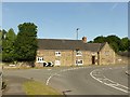
Hall Farmhouse, Kilburn
Possibly 18th century.
There is a bench mark http://www.geograph.org.uk/photo/5467568 below the road name sign far left.
Image: © Alan Murray-Rust
Taken: 17 Jul 2017
0.10 miles
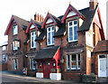
6
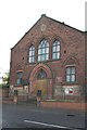
Kilburn Baptist Church
Kilburn Baptist Church, Kilburn, Derbyshire, SK380456
Image: © Rob Bradford
Taken: 30 May 2005
0.20 miles
7

Lower Kilburn
Lower Kilburn village straddles the former A61 (now known as the B6179). Although bypassed by the A38, this road is still busy with local quarry traffic.
Image: © Jerry Evans
Taken: 18 Oct 2007
0.21 miles
8
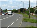
B6179 at Lower Kilburn
The old Derby to Ripley main road, formerly the A61, superseded by the A38 extension. The wide verge marks the course of the Little Eaton Gangway https://en.wikipedia.org/wiki/Little_Eaton_Gangway. This was one of the early wagon ways to make use of flanged iron rails. It was built in the 1790s by the pioneering engineer Benjamin Outram to connect local collieries to the Derby Canal. It was the last horse drawn tramroad to remain operational in the country, closing in 1908.
Image: © Alan Murray-Rust
Taken: 19 Jun 2017
0.23 miles
9

Grand Turk Cottage
Formerly the Grand Turk Inn.
Image: © Ian Calderwood
Taken: 21 Jul 2019
0.24 miles