
IMAGES TAKEN NEAR TO
Lydford Road, Meadow Lane Industrial Estate, ALFRETON, DE55 7RQ
Introduction
This page details the photographs taken nearby to Lydford Road, Meadow Lane Industrial Estate, DE55 7RQ by members of the Geograph project.
The Geograph project started in 2005 with the aim of publishing, organising and preserving representative images for every square kilometre of Great Britain, Ireland and the Isle of Man.

There are currently over 7.5m images from over14,400 individuals and you can help contribute to the project by visiting https://www.geograph.org.uk
Image Map
Images are licensed for reuse under creativecommons.org/licenses/by-sa/2.0
Notes
- Clicking on the map will re-center to the selected point.
- The higher the marker number, the further away the image location is from the centre of the postcode.
Image Listing (19 Images Found)
Images are licensed for reuse under creativecommons.org/licenses/by-sa/2.0
Image
Details
Distance
1

Meadow Lane Industrial Estate, Alfreton
Image: © Alex McGregor
Taken: 20 Jun 2011
0.07 miles
2

New industrial unit, Meadow Lane Industrial Estate
Image: © Alex McGregor
Taken: 20 Jun 2011
0.11 miles
3
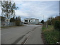
Meadow Lane, Alfreton, looking south
Looking towards the junction with Lydford Road, about where the railway line to Alfreton Colliery once crossed the road.
Image: © Christine Johnstone
Taken: 13 Nov 2017
0.16 miles
4

Crane hire depot
The western end of Meadow Lane Industrial Estate. You can see the cranes from the surrounding countryside in the valley of Alfreton Brook.
Image: © Bill Boaden
Taken: 5 Oct 2021
0.17 miles
5
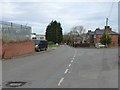
Houses at the north end of Meadow Lane
Built in the 1930s, close to Alfreton Colliery [opened 1895, closed 1968].
Image: © Christine Johnstone
Taken: 13 Nov 2017
0.17 miles
6
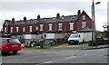
Colliery Row, Alfreton
Terraced houses built in the 1890s, just east of Alfreton Colliery [opened 1895, closed 1968].
Image: © Christine Johnstone
Taken: 13 Nov 2017
0.18 miles
7

Public open space, Meadow Lane industrial estate
At the junction of Salcombe Road and Meadow Lane. Three benches face some bushes and a low plaque. The plaque reads 'Meadow Lane Association 2002' and has images of things made or distributed locally, including jigsaw puzzles and floppy discs.
Image: © Christine Johnstone
Taken: 13 Nov 2017
0.18 miles
8

Alfreton water treatment works
The line of vegetation in front of the perimeter fencing, shows the course of Alfreton Brook. A flare stack burns off sewage gas close to the western perimeter fencing.
Image: © Nikki Mahadevan
Taken: 1 Sep 2006
0.18 miles
9
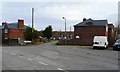
Entrance to Tavistock Square, off Meadow Lane, Alfreton
Housing built in the 1930s, close to Alfreton Colliery [opened 1895, closed 1968].
Image: © Christine Johnstone
Taken: 13 Nov 2017
0.18 miles
10

Alfreton Sewage Treatment Works
A necessary facility sited by Alfreton Brook.
Image: © Bill Boaden
Taken: 5 Oct 2021
0.20 miles