
IMAGES TAKEN NEAR TO
Morewood Drive, ALFRETON, DE55 7QW
Introduction
This page details the photographs taken nearby to Morewood Drive, DE55 7QW by members of the Geograph project.
The Geograph project started in 2005 with the aim of publishing, organising and preserving representative images for every square kilometre of Great Britain, Ireland and the Isle of Man.

There are currently over 7.5m images from over14,400 individuals and you can help contribute to the project by visiting https://www.geograph.org.uk
Image Map
Images are licensed for reuse under creativecommons.org/licenses/by-sa/2.0
Notes
- Clicking on the map will re-center to the selected point.
- The higher the marker number, the further away the image location is from the centre of the postcode.
Image Listing (55 Images Found)
Images are licensed for reuse under creativecommons.org/licenses/by-sa/2.0
Image
Details
Distance
1
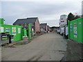
Building new houses off Meadow Lane, Alfreton
This is Nottingham Community Housing Association's Morewood Drive development with 20 new homes available to purchase through shared ownership. The site was formerly a depot.
Image: © Christine Johnstone
Taken: 13 Nov 2017
0.03 miles
2

Benchmark on #63 Meadow Lane
Ordnance Survey cut mark benchmark levelled at 114.047m above Newlyn Datum verified 1962
Image: © Roger Templeman
Taken: 25 Sep 2022
0.05 miles

4

Houses on NW side of Meadow Lane
There is an Ordnance Survey benchmark Image on the road face of the corner of the nearer house
Image: © Roger Templeman
Taken: 25 Sep 2022
0.06 miles
5
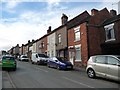
Houses on the west side of Meadow Lane, Alfreton
Probably built when Alfreton Colliery opened at the bottom of the hill in 1895.
Image: © Christine Johnstone
Taken: 13 Nov 2017
0.06 miles
6

Meadow Lane in Alfreton
Taken from the junction with Salcombe Road at the edge of the Industrial Estate.
Image: © Jonathan Clitheroe
Taken: 21 Apr 2012
0.06 miles
7

A pair of houses built in 1924, Alfreton
On the west side of Meadow Lane.
Image: © Christine Johnstone
Taken: 13 Nov 2017
0.07 miles
8
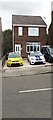
#46 Meadow Lane
Ordnance Survey documents indicate that a benchmark levelled at 121.100m above Newlyn Datum was verified in 1962 on the right hand side of the house at its front corner
Image: © Roger Templeman
Taken: 25 Sep 2022
0.08 miles
9

Public open space, Meadow Lane industrial estate
At the junction of Salcombe Road and Meadow Lane. Three benches face some bushes and a low plaque. The plaque reads 'Meadow Lane Association 2002' and has images of things made or distributed locally, including jigsaw puzzles and floppy discs.
Image: © Christine Johnstone
Taken: 13 Nov 2017
0.09 miles
10
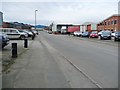
Salcombe Road, looking west
Part of Alfreton's Meadow Lane industrial estate.
Image: © Christine Johnstone
Taken: 13 Nov 2017
0.10 miles