
IMAGES TAKEN NEAR TO
Aumonier Way, ALFRETON, DE55 7QQ
Introduction
This page details the photographs taken nearby to Aumonier Way, DE55 7QQ by members of the Geograph project.
The Geograph project started in 2005 with the aim of publishing, organising and preserving representative images for every square kilometre of Great Britain, Ireland and the Isle of Man.

There are currently over 7.5m images from over14,400 individuals and you can help contribute to the project by visiting https://www.geograph.org.uk
Image Map
Images are licensed for reuse under creativecommons.org/licenses/by-sa/2.0
Notes
- Clicking on the map will re-center to the selected point.
- The higher the marker number, the further away the image location is from the centre of the postcode.
Image Listing (7 Images Found)
Images are licensed for reuse under creativecommons.org/licenses/by-sa/2.0
Image
Details
Distance
1
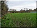
Open land, north of Leys School, Alfreton
Accessed from a path on the east side of Milton Avenue.
Image: © Christine Johnstone
Taken: 13 Nov 2017
0.14 miles
2
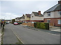
Houses on the east side of Milton Avenue, Alfreton
Part of an estate of social housing built in the 1930s. Most of the streets have a literary connection.
Image: © Christine Johnstone
Taken: 13 Nov 2017
0.19 miles
3
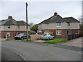
Flying the flag in Milton Avenue, Alfreton
Part of an estate of social housing built in the 1930s. Most of the streets have a literary connection.
Image: © Christine Johnstone
Taken: 13 Nov 2017
0.19 miles
4
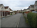
The northern end of Milton Avenue, Alfreton
Part of an estate of social housing built in the 1930s. Most of the streets have a literary connection.
Image: © Christine Johnstone
Taken: 13 Nov 2017
0.20 miles
5
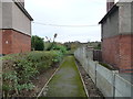
Path running east from Milton Avenue, Alfreton
Not a dead end, but zig-zagging right and left towards the allotments.
Image: © Christine Johnstone
Taken: 13 Nov 2017
0.22 miles
6
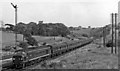
Diesel-hauled Down express approaching Alfreton & South Normanton station
View southward, towards Trent, Leicester and London; ex-Midland St Pancras - Leeds main line (via Trent and the Erewash Valley line to Chesterfield). By 1961, the principal expresses are graced with Diesels; here the 15.10 St Pancras - Leeds/Bradford has Type 4 'Peak' class 2,300 hp 1-Co-Co-1 No. D81 (later Class 45 No. 45.115).
Image: © Ben Brooksbank
Taken: 23 Jun 1961
0.22 miles
7
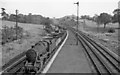
Down empties approaching Alfreton & South Normanton Station
View southward, towards Toton, Nottingham, Trent etc.; ex-Midland Erewash Valley main line. See Image for view in the opposite direction with the Station. Coal traffic was prodigious on this route while the North Midlands coalfield was fully active back in 1961: this Down empties (with Stanier 8F 2-8-0 No. 48176) is passing an Up loaded train on the other Slow line. The tip at Coates Park Colliery is prominent in the background.
Image: © Ben Brooksbank
Taken: 23 Jun 1961
0.23 miles