
IMAGES TAKEN NEAR TO
Manor Road, ALFRETON, DE55 7NH
Introduction
This page details the photographs taken nearby to Manor Road, DE55 7NH by members of the Geograph project.
The Geograph project started in 2005 with the aim of publishing, organising and preserving representative images for every square kilometre of Great Britain, Ireland and the Isle of Man.

There are currently over 7.5m images from over14,400 individuals and you can help contribute to the project by visiting https://www.geograph.org.uk
Image Map
Images are licensed for reuse under creativecommons.org/licenses/by-sa/2.0
Notes
- Clicking on the map will re-center to the selected point.
- The higher the marker number, the further away the image location is from the centre of the postcode.
Image Listing (31 Images Found)
Images are licensed for reuse under creativecommons.org/licenses/by-sa/2.0
Image
Details
Distance
1

Manor Road, South Wingfield
A corner of the B5035 as it enters the village from the southwest.
Image: © Andrew Hill
Taken: 1 Sep 2012
0.01 miles
2

"The Old Yew Tree Inn", South Wingfield
Image: © Neil Theasby
Taken: 25 Feb 2016
0.01 miles
3
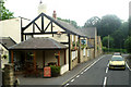
The Old Yew Tree on the B5035
As seen through the rear window of the 140 service bus
Image: © David Long
Taken: 22 Jun 2009
0.02 miles
4
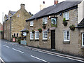
South Wingfield - Old Yew Tree Inn
For an alternative view, please see Image
Image: © Dave Bevis
Taken: 10 Nov 2010
0.02 miles
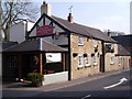
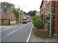

8
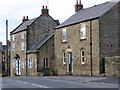
South Wingfield - The Manor
The left-most house on Manor Road is called "the Manor", but is not to be confused with the medieval Wingfield Manor (English Heritage) a mile to the south.
Image: © Dave Bevis
Taken: 10 Nov 2010
0.09 miles
9

Wingfield Hall and former stables
Wingfield Hall (on the right) date from the late eighteenth century https://historicengland.org.uk/listing/the-list/list-entry/1109154?section=official-list-entry The stable block also dates from the same period https://historicengland.org.uk/listing/the-list/list-entry/1109155?section=official-list-entry Barn Cottage (in front of the stable block, right) dates from the early nineteenth century https://historicengland.org.uk/listing/the-list/list-entry/1298841?section=official-list-entry
Image: © Jonathan Thacker
Taken: 13 Sep 2023
0.10 miles
