
IMAGES TAKEN NEAR TO
Market Place, ALFRETON, DE55 7NG
Introduction
This page details the photographs taken nearby to Market Place, DE55 7NG by members of the Geograph project.
The Geograph project started in 2005 with the aim of publishing, organising and preserving representative images for every square kilometre of Great Britain, Ireland and the Isle of Man.

There are currently over 7.5m images from over14,400 individuals and you can help contribute to the project by visiting https://www.geograph.org.uk
Image Map
Images are licensed for reuse under creativecommons.org/licenses/by-sa/2.0
Notes
- Clicking on the map will re-center to the selected point.
- The higher the marker number, the further away the image location is from the centre of the postcode.
Image Listing (37 Images Found)
Images are licensed for reuse under creativecommons.org/licenses/by-sa/2.0
Image
Details
Distance

3

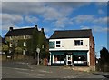
South Wingfield - Market
To the left of the shop is the Georgian house, The Malthouse.
Image: © Dave Bevis
Taken: 10 Nov 2010
0.02 miles
4

High Road, South Wingfield
Near the centre of South Wingfield. The path to the left drops down to Church Lane.
Image: © Bill Boaden
Taken: 4 Oct 2021
0.03 miles
5

High Road in South Wingfield
Looking north from a spot in the centre of the village. The imposing three-storey building on the left is The Malthouse.
Image: © Jonathan Clitheroe
Taken: 21 Apr 2012
0.03 miles
6

South Wingfield, shop and tractor
Village shop for sale; hope it remains open.
Image: © Peter Barr
Taken: 22 Nov 2010
0.03 miles
7

Retaining walls on Church Lane
Necessary engineering for the road to get down from the top of the ridge to the River Amber.
Image: © Bill Boaden
Taken: 4 Oct 2021
0.04 miles
8

Gospel Hall, South Wingfield
A place of worship on Inns Lane.
Image: © Andrew Hill
Taken: 1 Sep 2012
0.05 miles
9

Church Lane
Church Lane at South Wingfield in Derbyshire. A rather large collection of anchor plates on the stone wall suggests a history of stability issues over the years. The Wisteria has been a feature of this wall for many years and never fails to delight the author when passing though with one eye on the flowers and one on the hairpin bend!
Image: © Martin Froggatt
Taken: 14 May 2017
0.05 miles
10

A bend in the road, South Wingfield
A remarkable and rather unexpected feature along the B5035 through the village, a corner deeply set between retaining walls.
Image: © Andrew Hill
Taken: 1 Sep 2012
0.05 miles