
IMAGES TAKEN NEAR TO
Woodland Avenue, DE55 6NX
Introduction
This page details the photographs taken nearby to Woodland Avenue, DE55 6NX by members of the Geograph project.
The Geograph project started in 2005 with the aim of publishing, organising and preserving representative images for every square kilometre of Great Britain, Ireland and the Isle of Man.

There are currently over 7.5m images from over14,400 individuals and you can help contribute to the project by visiting https://www.geograph.org.uk
Image Map
Images are licensed for reuse under creativecommons.org/licenses/by-sa/2.0
Notes
- Clicking on the map will re-center to the selected point.
- The higher the marker number, the further away the image location is from the centre of the postcode.
Image Listing (15 Images Found)
Images are licensed for reuse under creativecommons.org/licenses/by-sa/2.0
Image
Details
Distance
1
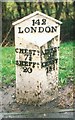
Old Milepost by the A61, Chesterfield Road
Cast iron post by the A61, in parish of SHIRLAND AND HIGHAM (NORTH EAST DERBYSHIRE District), roadside, on grass verge between path and hedge, on West side of road. Alfreton iron casting, erected by the Alfreton, Higham & Tibshelf turnpike trust in the 19th century.
Inscription reads:-
: CHEST.D / 7¾ / SHEFF.D / 20 : : 142 / LONDON : : ALFRE.N / 2¼ / DERBY / 15½ :
Milestone Society National ID: DE_CFAF07.
Image: © J Higgins
Taken: 1 Feb 2002
0.09 miles
2
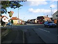
Strettea Lane junction with the A61
The eastern end of Strettea Lane joins the A61 (Chesterfield-Alfreton Road) at a staggered crossroads with Goose Green Lane. Compare the older western end of Strettea Lane Image
Image: © Nikki Mahadevan
Taken: 20 Jan 2007
0.10 miles
3
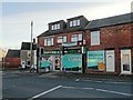
Higham Food and Wine Store, New Higham
Image: © Neil Theasby
Taken: 11 Dec 2015
0.12 miles
4
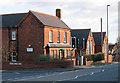
Shirland Primary School, Juniors
The Junior site of Shirland Primary School lies at the junction of Goose Green Lane and Main Road (A61). The Infant site can be found at the other end of the village at Hallfield Gate. The two sites used to be separate schools until they combined to become one in 1996.
Image: © Nikki Mahadevan
Taken: 20 Jan 2007
0.13 miles
5
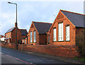
Shirland - Primary School
This is the old primary school site on Chesterfield Road. In September 2011, the school relocated to a new building on Park Road.
Image: © Dave Bevis
Taken: 9 Jan 2012
0.13 miles
6
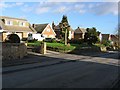
Strettea Lane, middle section
Modern detached properties line the wider middle section of Strettea Lane. Compare the older properties at the western end Image
Image: © Nikki Mahadevan
Taken: 20 Jan 2007
0.14 miles
7
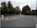
Higham - Belper Road Junction with the A61
Image: © Alan Heardman
Taken: 23 Sep 2007
0.16 miles
9
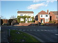
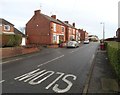
Goose Green Lane
Houses north of Shirland, North-east Derbyshire.
Image: © Peter Barr
Taken: 26 Nov 2010
0.19 miles
10
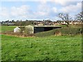
Farmland - Shirland and Higham
The perimeter of this square is lined by the roads through Shirland and Higham, but much of its centre is farmland. Houses in the distance line the roads of New Street and Stretta Lane in Higham. Polytunnels of Higham Nursery (accessed from the B6013 Belper Road) can also be seen to the left of the picture.
Image: © Nikki Mahadevan
Taken: 20 Jan 2007
0.23 miles