
IMAGES TAKEN NEAR TO
Blackwell Lane, ALFRETON, DE55 6JQ
Introduction
This page details the photographs taken nearby to Blackwell Lane, DE55 6JQ by members of the Geograph project.
The Geograph project started in 2005 with the aim of publishing, organising and preserving representative images for every square kilometre of Great Britain, Ireland and the Isle of Man.

There are currently over 7.5m images from over14,400 individuals and you can help contribute to the project by visiting https://www.geograph.org.uk
Image Map
Images are licensed for reuse under creativecommons.org/licenses/by-sa/2.0
Notes
- Clicking on the map will re-center to the selected point.
- The higher the marker number, the further away the image location is from the centre of the postcode.
Image Listing (46 Images Found)
Images are licensed for reuse under creativecommons.org/licenses/by-sa/2.0
Image
Details
Distance

2

Doehill House - View through trees from Stonebroom Lane
Image: © Alan Heardman
Taken: 28 Jan 2008
0.05 miles
3
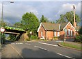
Doe Hill Station, Stonebroom
Doe Hill Station, now a house, is on Stonebroom Lane at the junction with Doe Hill Lane. The Mainline railway (London - Sheffield) still runs past it over the adjacent railway bridge.
Image: © Nikki Mahadevan
Taken: 18 Aug 2006
0.07 miles
4

Love Lane View
Footpath off to the left next to fingerpost.
Image: © Alan Heardman
Taken: 28 Jan 2008
0.09 miles

6
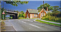
Doe Hill station (remains)
View eastward under the ex-Midland Erewash Valley main line: Chesterfield etc. left, Trent, Nottingham etc. right. The station was closed 12/9/60.
Image: © Ben Brooksbank
Taken: 29 Aug 1993
0.10 miles
7

Love Lane in Stonebroom
The dwelling visible here is Doehill Cottage and to the right is grazing pasture. The picture was taken on a bright autumnal Saturday in mid October.
Image: © Jonathan Clitheroe
Taken: 20 Oct 2012
0.10 miles
8

Stonebroom Lane - Junction with Love Lane
Image: © Alan Heardman
Taken: 28 Jan 2008
0.11 miles
9

Shell oil storage depot, Doe Hill Lane near Stonebroom
This photo of the Shell oil storage depot, off Doe Hill Lane, was taken from the footpath in the newly completed Doe Hill Community Park and Stonebroom Restoration Scheme. A flare stack? can be seen within its perimeter.
Image: © Nikki Mahadevan
Taken: 28 Sep 2006
0.12 miles
10

Doe Hill Lane
This photograph of Doe Hill Lane (B6014) was taken from a point approximately 50metres from the western end of the lane.
The Image is in two sections. The nearer section carries the Midland railway line between Chesterfield and Alfreton. Beyond Alfreton it becomes known as the Erewash Valley line and has a link to Nottingham before it rejoins the main Sheffield/London line south of Derby.
The far section of the bridge carries a spur to an oil depot situated off Doe Hill Lane beyond the bridge.
The road junction just seen to the right is with Stonebroom Lane.
The building on the right is part of what once was Doe Hill Station and is now a private residence.
For a more easterly (ahead) photograph of Doe Hill Lane, click here Image
For a more westerly (behind the viewpoint) photograph of the B6014, click here Image
See also this photograph by Nikki Mahadevan, Image which was taken from a few metres behind this viewpoint.
Image: © Alan Walker
Taken: 19 Mar 2007
0.12 miles