
IMAGES TAKEN NEAR TO
Stretton Road, ALFRETON, DE55 6GW
Introduction
This page details the photographs taken nearby to Stretton Road, DE55 6GW by members of the Geograph project.
The Geograph project started in 2005 with the aim of publishing, organising and preserving representative images for every square kilometre of Great Britain, Ireland and the Isle of Man.

There are currently over 7.5m images from over14,400 individuals and you can help contribute to the project by visiting https://www.geograph.org.uk
Image Map
Images are licensed for reuse under creativecommons.org/licenses/by-sa/2.0
Notes
- Clicking on the map will re-center to the selected point.
- The higher the marker number, the further away the image location is from the centre of the postcode.
Image Listing (44 Images Found)
Images are licensed for reuse under creativecommons.org/licenses/by-sa/2.0
Image
Details
Distance
1
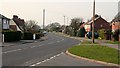
Stretton Road
Looking westerly along Stretton Road from its junction (right foreground) with Image
For a photograph of Stretton Road taken from a few metres behind the viewpoint and looking in the opposite direction, click here Image
For a more easterly (behind the viewpoint) photograph of Stretton Road, click here Image
Image: © Alan Walker
Taken: 28 Mar 2007
0.01 miles
3

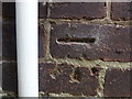
Evershill Close
This photograph of Evershill Close was taken from its junction with Image
Image: © Alan Walker
Taken: 28 Mar 2007
0.08 miles
4
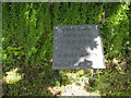
Centre of England
Sign stating that the tree above is at the centre of England. See:-Image
Image: © Tony Bacon
Taken: 30 May 2010
0.09 miles
5
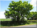
Centre of England Tree
This Oak Tree is reputed to be sited at the dead centre of England. See picture:- Image
Image: © Tony Bacon
Taken: 30 May 2010
0.09 miles
6
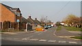
Evershill Lane
Looking north-easterly along Evershill Lane from its junction (foreground) with Stretton Road.
To the left Image (B6014) continues toward its junction with the Main Road (A61) near Stretton Hillside.
To the right Image (B6014) continues toward its junction with Holland Close and the village centre.
For a more north-easterly (ahead) photograph of Evershill Lane, click here Image
Image: © Alan Walker
Taken: 28 Mar 2007
0.10 miles
7

Evershill Lane
The photograph shows the junction of Evershill Lane (foreground) with Image
For a more northerly (ahead) photograph of Evershill Lane, click here Image
For a more south-westerly (behind the viewpoint) photograph of Evershill Lane, click here Image
Image: © Alan Walker
Taken: 28 Mar 2007
0.10 miles
8
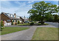
By Stretton Road, Morton
Looking southeast from the end of Evershill Lane.
Image: © Andrew Hill
Taken: 27 May 2011
0.11 miles
9

Stretton Road
Looking westerly along Stretton Road (B6014). The photograph was taken from a point near to a public footpath that runs across the churchyard to Church Lane via the Image
Off the right of the photograph is a junction with Holland Close.
For a photograph of Stretton Road from approximately the same viewpoint, but looking in the opposite direction toward its junction with Main Road and Church Lane, click here Image
For a more easterly (behind the viewpoint) photograph of the B6014, click here Image
Image: © Alan Walker
Taken: 21 Mar 2007
0.11 miles
10
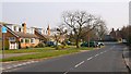
Stretton Road
Looking easterly along Stretton Road from its junction (left) with Image
For a photograph of Stretton Road taken from a few metres behind the viewpoint and looking in the opposite direction, click here Image
For a more easterly (ahead) photograph of Stretton Road, click here Image
Image: © Alan Walker
Taken: 28 Mar 2007
0.15 miles