
IMAGES TAKEN NEAR TO
Burnshaw Street, ALFRETON, DE55 6FZ
Introduction
This page details the photographs taken nearby to Burnshaw Street, DE55 6FZ by members of the Geograph project.
The Geograph project started in 2005 with the aim of publishing, organising and preserving representative images for every square kilometre of Great Britain, Ireland and the Isle of Man.

There are currently over 7.5m images from over14,400 individuals and you can help contribute to the project by visiting https://www.geograph.org.uk
Image Map
Images are licensed for reuse under creativecommons.org/licenses/by-sa/2.0
Notes
- Clicking on the map will re-center to the selected point.
- The higher the marker number, the further away the image location is from the centre of the postcode.
Image Listing (19 Images Found)
Images are licensed for reuse under creativecommons.org/licenses/by-sa/2.0
Image
Details
Distance
1
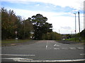
North end of Mickley Lane, Stretton Hillside
Seen from the A61.
Image: © Richard Vince
Taken: 13 Oct 2018
0.06 miles
3
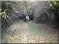
Footpath to the A61, Stretton Hillside
This path becomes very steep just before it reaches the A61; being dry and quite stony on this occasion, it was somewhat treacherous.
Image: © Richard Vince
Taken: 13 Oct 2018
0.06 miles
4
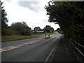
A61, Stretton Hillside
Looking towards Derby.
Image: © Richard Vince
Taken: 13 Oct 2018
0.07 miles
5

Into the valley, Stretton Hillside
The valley of the Smithy Brook, to be precise. A public footpath heads through this field in the general direction of Ogston Reservoir.
Image: © Richard Vince
Taken: 13 Oct 2018
0.08 miles
8
Mickley Lane - Junction with Main Road (A61)
Image: © Alan Heardman
Taken: 7 Oct 2007
0.09 miles
9

Stretton Hillside
Looking towards Ogston from a footpath at the eastern edge of the grid square close to the A61 Road. The Chesterfield-Alfreton railway line passes through the wooded fold at the bottom of the field.
Image: © Jonathan Clitheroe
Taken: 10 May 2014
0.12 miles
