
IMAGES TAKEN NEAR TO
Hazelwood Close, ALFRETON, DE55 5RA
Introduction
This page details the photographs taken nearby to Hazelwood Close, DE55 5RA by members of the Geograph project.
The Geograph project started in 2005 with the aim of publishing, organising and preserving representative images for every square kilometre of Great Britain, Ireland and the Isle of Man.

There are currently over 7.5m images from over14,400 individuals and you can help contribute to the project by visiting https://www.geograph.org.uk
Image Map
Images are licensed for reuse under creativecommons.org/licenses/by-sa/2.0
Notes
- Clicking on the map will re-center to the selected point.
- The higher the marker number, the further away the image location is from the centre of the postcode.
Image Listing (86 Images Found)
Images are licensed for reuse under creativecommons.org/licenses/by-sa/2.0
Image
Details
Distance
1
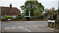
Junction of Addison Street with High Street
Addison Street connects King Street (behind the viewpoint) with Image (B6014, ahead).
In Addison Street there is this Image
Image: © Alan Walker
Taken: 16 Oct 2007
0.04 miles
2
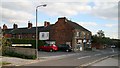
Waverley Street
This photograph is looking toward (ahead, left) the south-eastern end of Waverley Street and its junction with Image
Across the junction is the cul-de-sac, Heathfield Gardens.
On the left is a Image
On the right is the entrance to the car park for the Co-op Pharmacy and Staffa Health Centre.
Image: © Alan Walker
Taken: 19 Oct 2007
0.06 miles
3

High Street
Running across the bottom of the picture, this northerly facing photograph is of Image at its junction with Image
The building on the corner of High Street and Waverley Street is Renaissance Hair Salon.
At the end (on the right) of this row of house is the Image
For a more north-easterly (ahead, right) photograph of High Street, click here Image
For a more south-westerly (left, behind the viewpoint) photograph of High Street, click here Image
Image: © Alan Walker
Taken: 19 Oct 2007
0.06 miles
4

Tibshelf - High Street - Nos 160 to 182
Stone-built terrace.
Image: © Dave Bevis
Taken: 22 Mar 2016
0.06 miles
5

Track connecting Addison Street to Waverley Street
This track connecting Addison Street (ahead) to Image (in the foreground) runs by the side of a Image
Image: © Alan Walker
Taken: 19 Oct 2007
0.07 miles
6

Tibshelf - High Street - Nos 174 to 182
Stone-fronted terrace.
Image: © Dave Bevis
Taken: 22 Mar 2016
0.08 miles
8

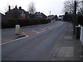
High Street
This photograph is of Image (running across the picture) at its junction with Image and Heathfield Gardens.
The building on the corner of High Street and Waverley Street is the Co-op Pharmacy.
Image: © Alan Walker
Taken: 19 Oct 2007
0.08 miles
9
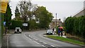
High Street
The photograph shows the north-eastern end of High Street (B6014) and was taken from near the Image (behind the viewpoint).
The building ahead (right of centre) is the Image, which sits at the junction (a Image) of High Street, Image and Image
For a more south-westerly (behind the viewpoint) photograph of High Street, click here Image
Image: © Alan Walker
Taken: 16 Oct 2007
0.08 miles
10

Redundant church building
This church building in Addison Street was a Methodist Church. The fabric is beginning to show signs of neglect.
By the near side of the chapel is a Image
Addison Street connects King Street (ahead, right). The Image is behind the viewpoint to the right.
Image: © Alan Walker
Taken: 16 Oct 2007
0.08 miles