
IMAGES TAKEN NEAR TO
Little Fen, ALFRETON, DE55 5QP
Introduction
This page details the photographs taken nearby to Little Fen, DE55 5QP by members of the Geograph project.
The Geograph project started in 2005 with the aim of publishing, organising and preserving representative images for every square kilometre of Great Britain, Ireland and the Isle of Man.

There are currently over 7.5m images from over14,400 individuals and you can help contribute to the project by visiting https://www.geograph.org.uk
Image Map
Images are licensed for reuse under creativecommons.org/licenses/by-sa/2.0
Notes
- Clicking on the map will re-center to the selected point.
- The higher the marker number, the further away the image location is from the centre of the postcode.
Image Listing (49 Images Found)
Images are licensed for reuse under creativecommons.org/licenses/by-sa/2.0
Image
Details
Distance
1
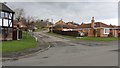
Junction with Sunny Bank
This is not the original route of the road, Sunny Bank. The name was applied to this cul-de-sac when the area was redeveloped and the housing estate was built.
The original route was some 60m to the right of the viewpoint and connected the B6014 at the south-western end of High Street with the old Tibshelf Bottom Colliery.
Behind the viewpoint is a Image runs parallel with Shetland Road and along the edge of the Tibshelf Recreation Ground.
Image: © Alan Walker
Taken: 4 Feb 2018
0.04 miles
2

Looking toward Shetland Road from the Silverhill Trail
A children's play area on the corner of Shetland Road and Sunny Bank. The photograph also shows housing on the southern edge of Tibshelf.
Image: © Alan Walker
Taken: 21 Mar 2017
0.06 miles
3
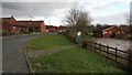
Shetland Road
The photograph shows the south-western end of Shetland Road and the pavilion for Tibshelf Recreation Ground.
Through the gate is a Image that follows the edge of the recreation ground and leads to a children's play area.
Some 350m ahead Shetland Road ends at a Image
A short distance behind the viewpoint is Newton Road (B6026).
Image: © Alan Walker
Taken: 4 Feb 2018
0.08 miles
4
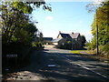
Tibshelf - View from Sunny Bank
Looking back towards the sharp bend entering Tibshelf.
Image: © Alan Heardman
Taken: 19 Oct 2007
0.09 miles
5
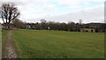
Footpath
The photograph shows a footpath following the edge of the Tibshelf Recreation Ground and leading to a children's play area.
In the centre of the image is an exercise area and on the far right the row of houses is Image
Off to the left of the photograph is Shetland Road and its Image
Image: © Alan Walker
Taken: 4 Feb 2018
0.09 miles
6
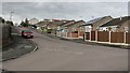
Junction with Staffa Drive
The photograph shows the junction of Shetland Road (behind the viewpoint) with Staffa Drive (ahead and right).
To the right Image leads to a small children's play area through which there is access to the Five Pits Trail.
Image: © Alan Walker
Taken: 4 Feb 2018
0.10 miles
7

Tibshelf - Derelict Clubhouse on Newton Road (B6026)
Image: © Alan Heardman
Taken: 30 Jan 2009
0.10 miles
8
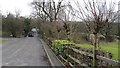
Sunny Bank
This road leads to Image and then, just beyond, a car park for access to The Five Pits Trail and Image
To the right of the viewpoint is Tibshelf Recreation Ground and a children's play area.
A few metres behind the viewpoint is a junction with Shetland Road, where a sign names this road as 'SUNNYBANK' whereas the OS map includes a space and ascribes the name 'SUNNY BANK' to the road.
Image: © Alan Walker
Taken: 4 Feb 2018
0.11 miles
9
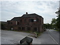
Former Scout Troop building
A very faded notice indicates the building was once used by the Tibshelf Baden Powell Scout Group.
Originally the Tibshelf and Newton Miners' Welfare, built by the Babbington Colliery Company in 1865. The building closed as a Welfare in 1985 and was used as the Scout HQ from 1987 to 1990. (thanks to Ivan Brentnall of Tibshelf Local History and Civic Society for this information)
Image: © Peter Barr
Taken: 5 Jun 2011
0.12 miles
10

Estate Housing, Tibshelf - Aerial Photo
The photo was taken during a helicopter ride. It shows housing either side of Tibshelf High Street. The main road around the housing is Staffa Drive.
Image: © Nikki Mahadevan
Taken: 27 Sep 2003
0.12 miles